


WEST PALM BEACH, Fla. — A strong cold front moves through South Florida on Thursday morning, bringing the highest rain chances of the week.
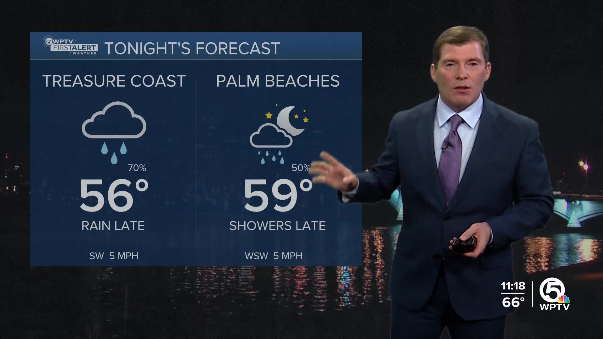
Rain will start to move in after midnight in the Treasure Coast and into the Palm Beaches during the early morning hours. A few rumbles of thunder are possible in heavy downpours. However, rainfall totals aren't too impressive— a couple of tenths of an inch of rain.
Behind the front, noticeably cooler and breezy conditions move in on Thursday afternoon. Highs will struggle to reach the upper 60s inland, with low to mid-70s along the coast.
A much colder and drier air mass settles in Thursday night into Friday morning.
HOW COLD WILL IT GET?
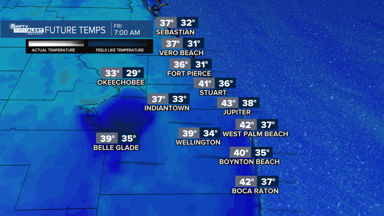
Friday will be the coldest morning, with temperatures dropping into the upper 30s to lower 40s. With gusty north winds, wind chills could dip into the 20s near Lake Okeechobee and the low to mid-30s elsewhere.
Cold weather precautions may be needed for pets, plants, and sensitive pipes.
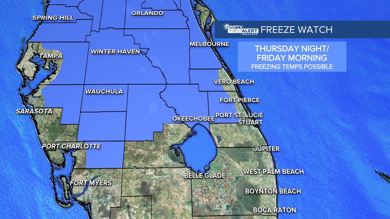
A Freeze Watch is in effect for all of Okeechobee County along with interior Indian River and St. Lucie counties that are located west of Florida's Turnpike, late Thursday night through Friday morning.
Interior sections could drop down into the upper 20s, low 30s Friday morning. As for coastal areas like Vero Beach, Fort Pierce, Port St. Lucie and Stuart, the proximity to the warm water will spare them from freezing temperatures.
Martin County and Palm Beach County are not included in the watch.
Both St. Lucie and Okeechobee counties will offer cold-weather shelters for those in need starting Thursday night.
MORE WEATHER: Radar | Alerts | 7-Day Forecast | Hourly Forecast
The biggest concern is that sub-freezing temperatures could kill plants, crops and other sensitive vegetation, especially out towards Lake Okeechobee. There's also a possibility that unprotected outdoor plumbing could be affected as well. You can drip your faucets to help prevent freezing or bursting pipes.
Make sure to dress in layers on Friday, as high temperatures will be limited to the middle 60s.
Temperatures rebound Saturday and Sunday into the low to mid-70s, before another dry cold front arrives late Sunday into Monday. That system could bring another round of chilly mornings, with lows again in the 30s and 40s.


