
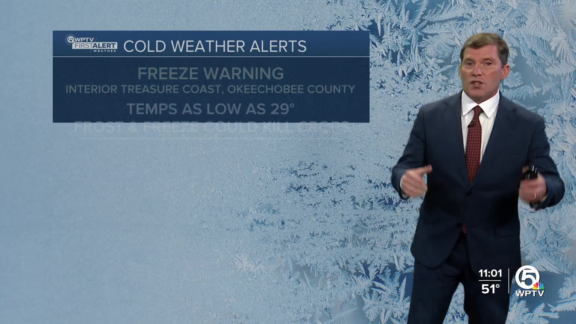


A Freeze Warning has been issued for inland St. Lucie and Indian River counties, as well as Okeechobee County from 1 a.m. to 9 a.m. Friday. Frost and freeze conditions could kill crops, and wind chill could be hazardous for those without adequate warmth.
A Cold Weather Advisory is in effect for coastal St. Lucie, and Indian River counties, as well as inland Martin and Palm Beach counties from 3 a.m. to 9 a.m. Friday. Wind chills as low as 30 are expected for most of South Florida.
A strong cold front moves across the region Thursday, bringing gusty winds and a sharp drop in temperatures by Friday morning.
MORE WEATHER: Radar | Alerts | 7-Day Forecast | Hourly Forecast

Weather News
Cold weather shelters to open in these counties on Thursday
Behind the front, winds will shift to the west-northwest and strengthen significantly, with gusts between 25 and 30 mph this afternoon and evening. These winds will create hazardous boating conditions, prompting a Small Craft Advisory across all local waters and Lake Okeechobee. Conditions begin to improve on Friday morning.
The most impactful part of this system arrives tonight into early Friday as much colder air pours in.
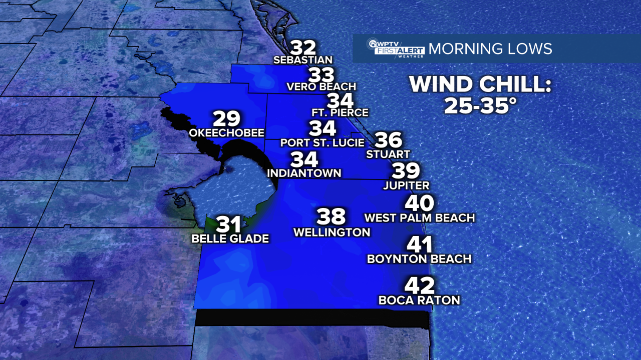
Interior areas near Lake Okeechobee, lows will be near or below freezing. Coastal area lows will be in the upper 30s to mid-40s.
Wind chill values may drop into the mid-20s near the lake and mid-30s closer to the coast.
Friday stays cool by South Florida standards, with afternoon highs mainly in the middle 60s.

The weekend stays on the cooler side with late nights/early mornings in the 50s. Dry weather dominates through Saturday with gradual warming into the low 70s.
Another dry cold front is expected late Sunday into early Monday. A couple of showers are possible, but the main effect of the front will once again be chillier weather as lows dip into the upper 30s and 40s.
Looking ahead to next week, it will be breezy and cool on Monday with a gradual warm up and more sunshine through the rest of the week.


