
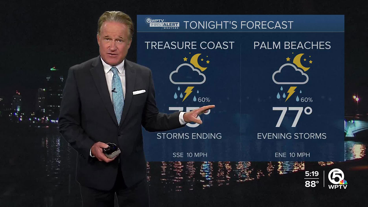


WEST PALM BEACH, Fla. — A few storms linger inland, but they are beginning to wind down for the night. Clouds will partially clear out. Overnight remains warm and muggy, with lows in the mid to upper 70s.
Thursday will be partly sunny and humid with scattered showers/thunderstorms developing along the sea breeze in the afternoon.
The strongest storms could bring frequent lightning, gusty winds, and heavy downpours that may cause brief flooding in poor drainage spots.
Temperatures will run slightly above normal. Highs will reach the upper 80s to lower 90s across much of the area, with feels-like temperatures climbing near the triple digits before storms develop.
MORE WEATHER: Radar | Alerts | 7-Day Forecast | Hourly Forecast
Friday and through the weekend will be a little drier with some sunshine with only a few spotty afternoon storms.
As we look towards the weekend, the tropics will be worth watching closely.
A disturbance near the Caribbean could develop as it moves toward the Bahamas, while newly formed Humberto lingers farther east.
Forecast confidence is still low on where these systems will go or how they may interact, but at the very least, Florida’s east coast should expect continued rough surf and rip current risks.
It is a reminder that we are in the peak of hurricane season, so now is the time to make sure your emergency plan is in place.


