


WEST PALM BEACH, Fla. — High pressure is settling across South Florida this weekend, bringing a stretch of quiet, warm, and very dry weather for the Treasure Coast and Palm Beaches.
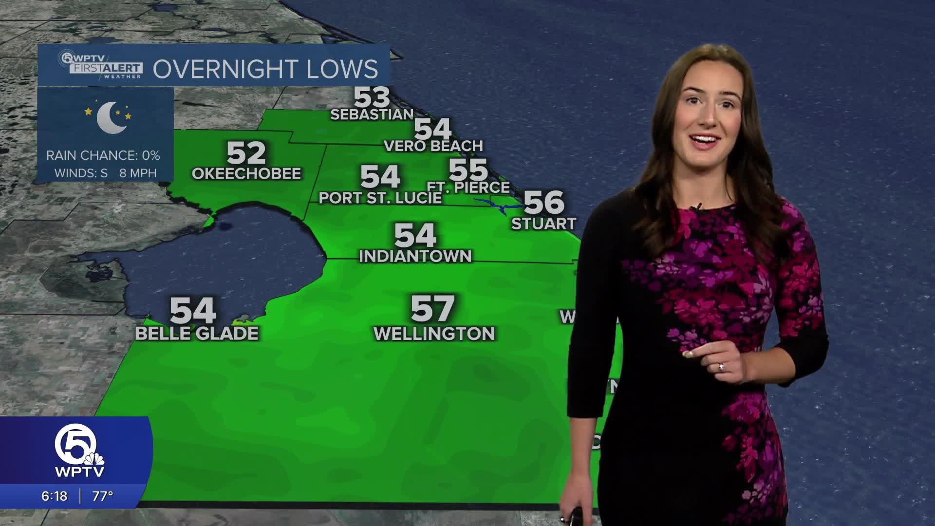
Skies will stay mostly clear tonight and it will feel comfortable through the early evening. You may want a light jacket or sweater if you are planning on eating outdoors or going for a walk after sundown. By morning, lows will fall into the mid 50s for the Treasure Coast and near 60 for the Palm Beaches.
Sunday's forecast features plenty of sunshine which will allow for temperatures to steadily climb into the lower 80s. Even warmer air builds through early next week as many spots push into the mid 80s.
MORE WEATHER: Radar | Alerts | 7-Day Forecast | Hourly Forecast
This dry pattern is being driven by strong high pressure overhead, which is also limiting cloud cover and rain chances. In fact, rain is not expected through the next few days and with lower humidity levels, fire concerns are elevated.
Even with recent rain and lighter winds, the combination of dry air and warm temperatures means vegetation can dry out quickly, so extra caution is advised.
At the beaches, conditions remain dangerous despite the nice weather. A persistent northeast swell is keeping a high risk of rip currents along the Atlantic coastline.
Even experienced swimmers are urged to stay out of the water, as these currents can quickly pull you away from shore. Looking ahead, the pattern begins to shift slightly by the middle of next week.
A weak front will attempt to move into Florida around Tuesday into Wednesday, bringing a small increase in moisture and a slight chance for a few showers, mainly north of the Palm Beaches and toward the Treasure Coast.
Rainfall looks limited at this point, and most areas will only see brief, spotty activity if anything develops.
Temperatures will remain above normal through the week, with highs continuing in the 80s and even a few inland locations nearing the upper 80s by late week.


