
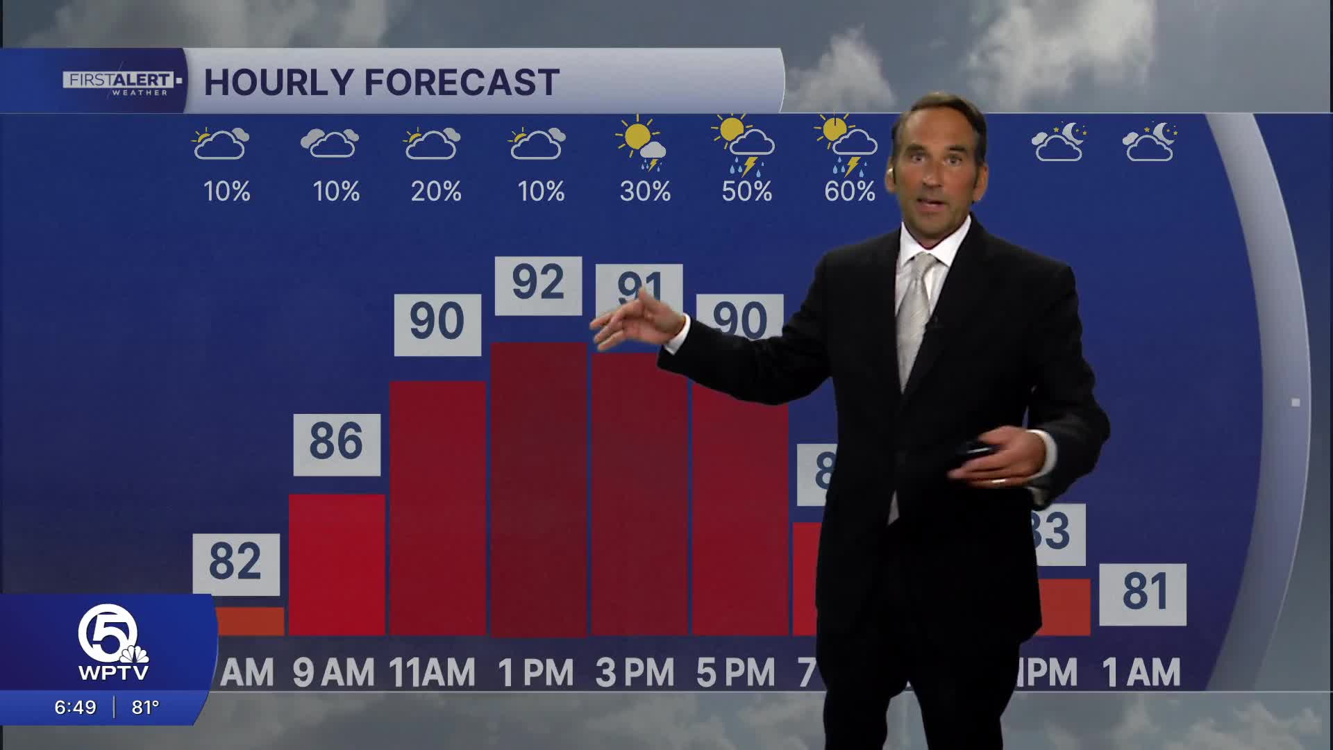


WEST PALM BEACH, Fla. — Summer heat is firmly in control across the Palm Beaches, with temperatures climbing into the lower 90s this afternoon. Combined with tropical humidity, it will feel much hotter, with heat index values reaching 105 to 110 degrees during the peak heating hours from late morning through early evening.
A Heat Advisory has been issued from noon to 7PM today for the entire area. The biggest concern for the Palm Beaches and the Treasure coast is the combination of intense sunshine, high humidity, and dangerous heat indices near 110°. Limit strenuous outdoor activity during the afternoon, stay hydrated, and seek shade or air conditioning whenever possible.
It could be a bit hazy through the morning due to the wildfire smoke drifting over our area. The winds will turn to come out of the southeast which should give us a little more sunshine today compared to yesterday. While most communities along the coast stay dry for much of the day, the sea breeze will help spark a few afternoon thunderstorms, especially inland and west of I-95. Any storm that develops could produce heavy downpours, frequent lightning, and brief gusty winds through the evening.
MORE WEATHER: Radar | Alerts | 7-Day Forecast | Hourly Forecast
The heat continues through the weekend, but afternoon thunderstorm coverage will gradually increase. Storms will become more widespread each day through Father's Day on Sunday, helping to knock temperatures down slightly after they reach the lower 90s each afternoon. Despite the storms, heat index values up to 105 degrees will remain common.

In addition to Father's Day, the summer solstice takes place at 4:24 AM on Sunday— marking the longest day of the year.
**Portions of this story were assisted by artificial intelligence tools and reviewed by a WPTV journalists to ensure accuracy, clarity, and adherence to editorial standards.


