


WEST PALM BEACH, Fla. — Once the front passes overnight, the weather will change dramatically. Much chillier air will rush into the region with breezy, northerly winds. Temperatures will range from the 50s inland and in the Treasure Coast to the lower 60s for the Palm Beaches.
St. Patrick's Day

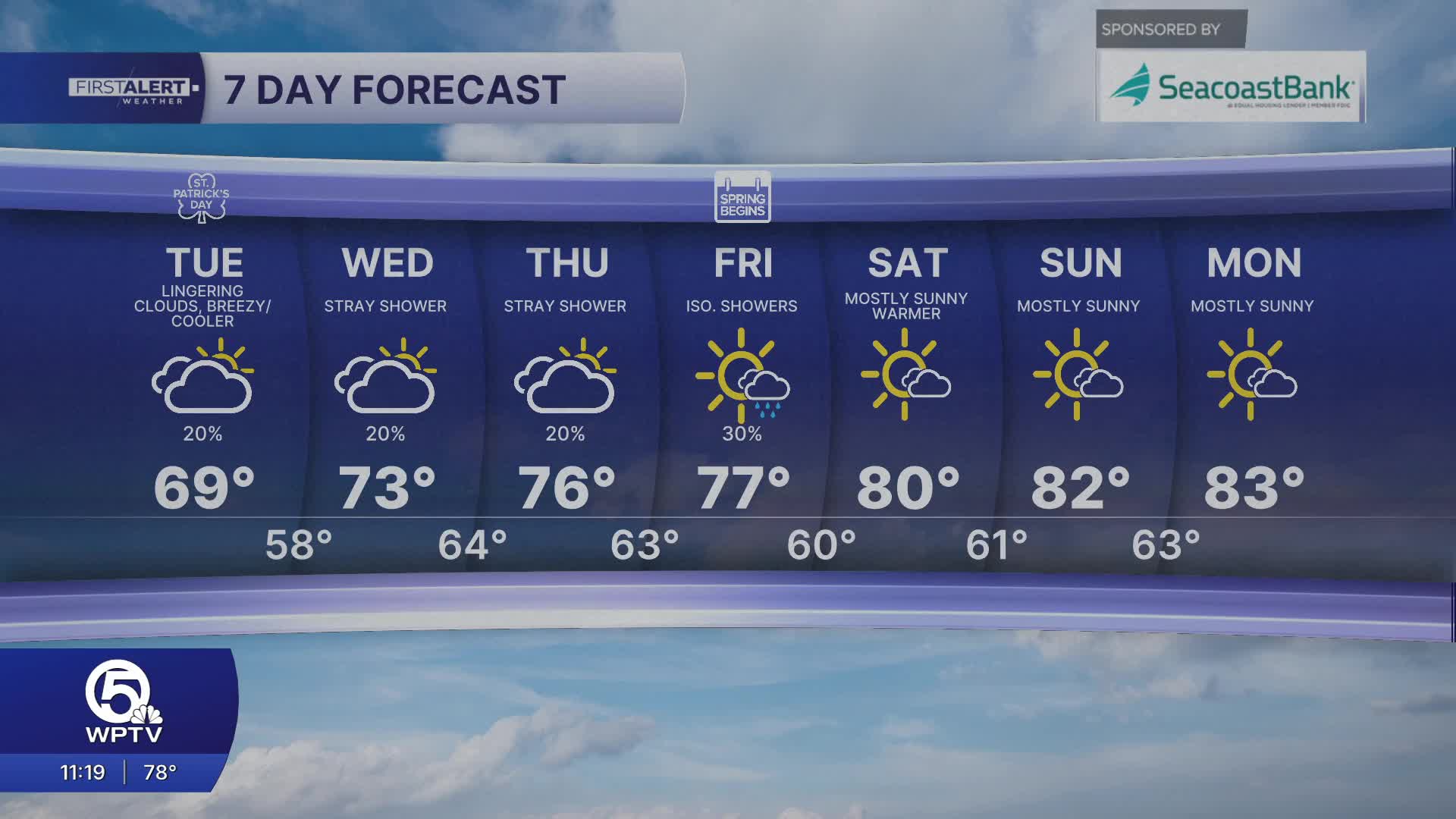
A few showers are possible Tuesday morning as the front pushes out of Palm Beach County. Cloudy skies linger the rest of the day. Afternoon highs on Tuesday will be nearly 20 degrees cooler than Monday, topping out mainly in the 60s.
Boaters should also be cautious, as hazardous marine conditions are expected with building seas and strong winds. A small craft advisory has been issued for our coastal waters through Tuesday. Also, beach goers and spring breakers will have to deal with rip currents. It's recommended to only swim near lifeguards.

MORE WEATHER: Radar | Alerts | 7-Day Forecast | Hourly Forecast
Even chillier air arrives Wednesday morning with lows in the lower 50s. A gradual warming is expected later in the week, with a return to 80-degree weather possible by the weekend.
We will hang onto clouds through Friday then clear out and see a lot of warm sunshine over the weekend.
**Portions of this story were assisted by artificial intelligence tools and reviewed by a WPTV journalist to ensure accuracy, clarity, and adherence to editorial standards.


