


WEST PALM BEACH, Fla. — The Palm Beaches and Treasure Coast are in for a stretch of warm, sunny and dry weather as high pressure dominates the forecast through the start of the week.
It will be a pleasant night with temperatures staying warm, mainly in the 70s, through dusk. Temperatures will fall overnight, ranging from the lower 50s inland to the upper 50s, near 60 for the coast.
With little to no rainfall expected and humidity levels remaining low, there is a fire risk across our area. Even with rain recently, the combination of warm and dry air can quickly dry out vegetation especially since we are still in a drought.

There is the chance for some spotty showers this week, although rain totals are expected to remain low. A weak front will attempt to move into the area late Tuesday and Wednesday, staying mainly near the Treasure Coast. While the front won't make a full passage through the area, we will see a slight uptick in moisture with and the chance for a few showers or t-storms on Wednesday. Isolated showers are possible Thursday and Friday, however we will still see lots of sunshine.
Temperatures are expected to increase into the mid 80s this week with some inland spots approaching the upper 80s. Early morning lows look comfortably cool in the lower-mid 60s.
MORE WEATHER: Radar | Alerts | 7-Day Forecast | Hourly Forecast
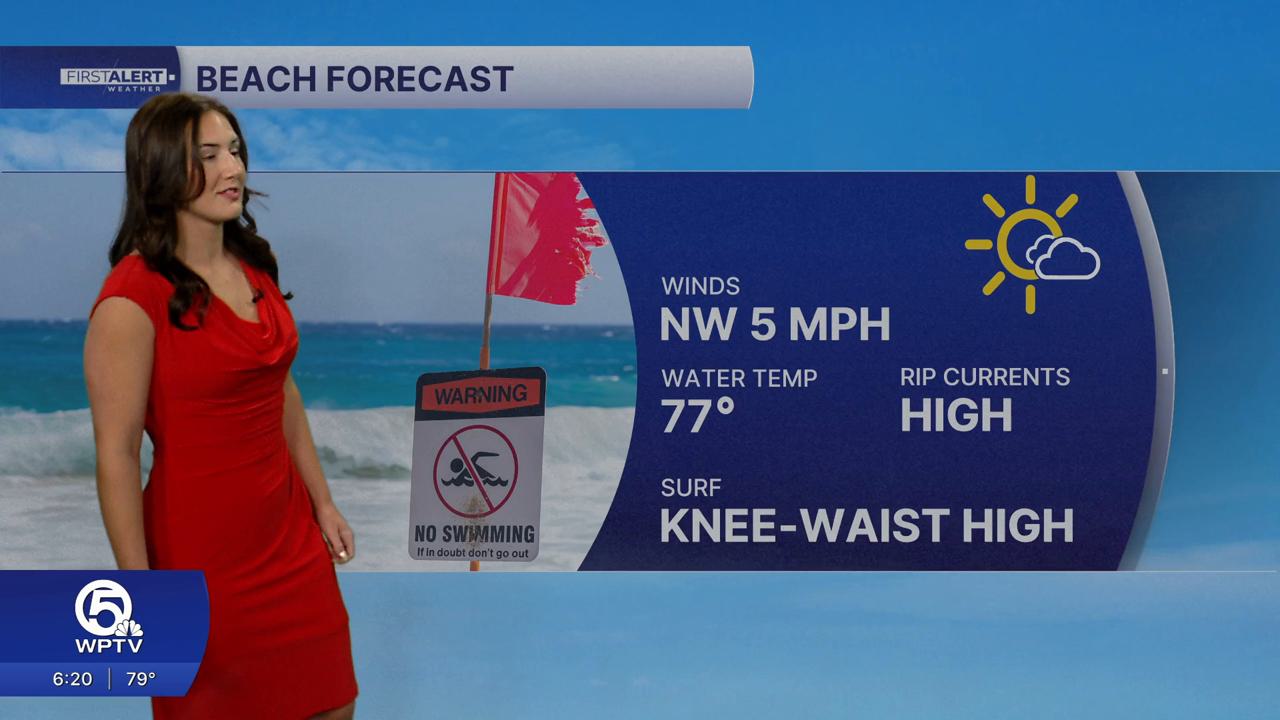
The east-northeasterly swell, that has been creating the dangerous rip currents along our beaches, will start to decrease as we head into Monday. While conditions are improving, a high rip current risk still remains for our Palm Beaches— so use caution entering the water. Despite the inviting weather, rip currents can quickly pull swimmers away from shore.


