


WEST PALM BEACH, Fla. — The wet pattern of afternoon showers and thunderstorms will persist over the next several days.
It won't be a washout all weekend, but we are tracking afternoon and evening storms with coverage increasing on Sunday. Heavy rainfall, gusty winds, and frequent lightning remain possible with any thunderstorm.
MORE WEATHER: Radar | Alerts | 7-Day Forecast | Hourly Forecast
It will feel warm and muggy overnight as the rain comes to an end.
Saturday starts with some sunshine peeking through the clouds. Storms look to fire up first in the Treasure Coast after 2 PM.
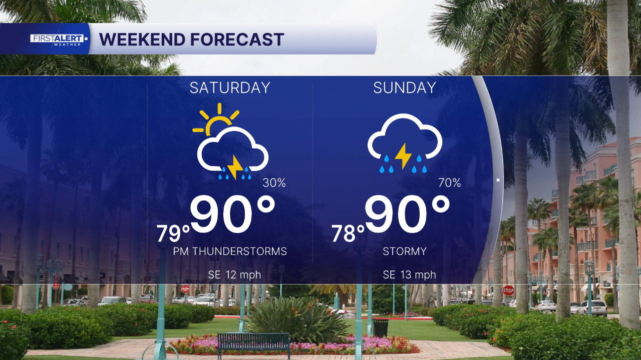
Heat indices will be high over the weekend, which could result in heat illness during prolonged exposure if precautions are not taken. Highs will be around 90 degrees with a "feels like" temperatures near 100.
The wind will be fairly calm for beach and boating, but be aware of the chance for afternoon storms. Sunday will bring more storms to the area than Saturday, so plan ahead.
Overnight, rain clears out, but some cloud cover stays. Hopefully enough to catch a glimpse of the blue micromoon this weekend. A blue moon isn't actually blue, but is the second full moon of a month—which happens once every 2-3 years. A micromoon is a full moon that is the farthest distance away from earth in its orbit. It appears slightly smaller. It will be 100% full at 4:45 AM Sunday, so you will be able to catch it both Saturday and Sunday night.
The wet pattern continues through at least early next week. Humidity will lower a bit later in the week allowing for it to feel not as toasty with highs in the mid-upper 80s.


