


A Wind Advisory has been issued for Indian River, St. Lucie, Martin, and Okeechobee counties from noon to 5 PM Sunday.
Gusty winds will blow around light, unsecured objects. Tree limbs and palm fronds could be blown down.
Temperatures are not as chilly tonight with anticipated lows in the mid-upper 50s for areas around Lake Okeechobee as well as the Treasure Coast with the lower-mid 60s expected for the Palm Beaches.
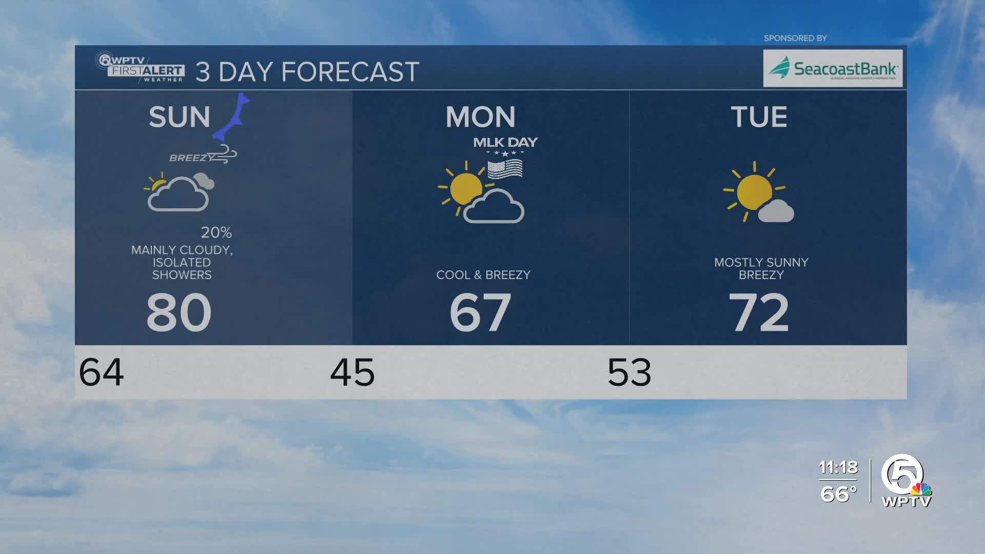
Changes arrive on Sunday as another cold front moves toward the region. Moisture will increase ahead of the front, bringing overcast skies and a few showers to the area, especially during the late morning and afternoon hours.
Rain will not be widespread and thunderstorms are not expected. Temperatures will still warm into the upper 70s to near 80 ahead of the front. The wind will pick up Sunday afternoon as the front arrives. Occasional gusts up to 30mph are possible.
Much colder air pours in Sunday night behind the front, setting the stage for a chilly start to the workweek.
MORE WEATHER: Radar | Alerts | 7-Day Forecast | Hourly Forecast
Boaters should also be prepared for deteriorating marine conditions late Sunday into early next week as winds and seas build behind the front, while a moderate risk of rip currents continues.
By early Monday morning, temperatures will drop into the mid 30s west of Lake Okeechobee, with low to middle 40s to lower 50s along the Treasure Coast and Palm Beaches.
Gusty northwest winds will make it feel even colder, with wind chills dipping into the 30s inland and 40s closer to the coast.
Monday stays cool and dry with highs struggling to reach the middle 60s, especially inland.
A slow warming trend follows through midweek as winds turn more northeasterly to easterly, allowing temperatures to moderate back into the 70s by Wednesday.
Looking ahead to late week, forecast confidence decreases, but there are signs another system could bring additional rain chances Thursday into Friday along with continued warming.


