


WEST PALM BEACH, Fla. — South Florida will enjoy a warm and mostly dry weekend, but changes are on the way as winds increase Monday and marine and beach conditions deteriorate early next week.
You may want a light jacket if you have plans in the Treasure Coast Sunday morning as lows will be near 60 in Vero Beach. Temperatures will be warmer the further south you are, in the upper 60s for South Palm Beach County. Patchy fog could develop in the early morning hours, especially around Lake Okeechobee. Fog will dissipate shortly after sunrise.
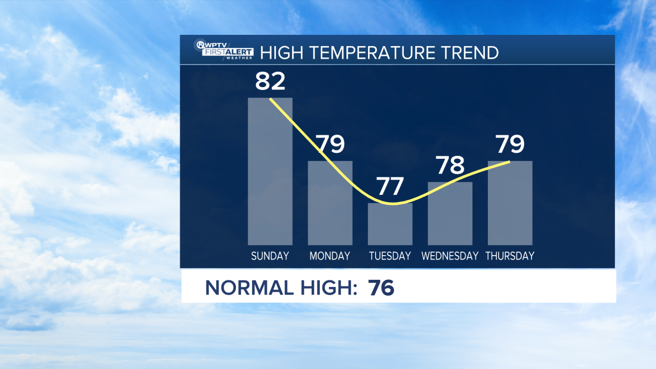
Sunday is the first day of winter! The forecast looks mostly to partly sunny and warm with highs again in the low to mid 80s. It will start to feel breezier by late day.
Most areas will stay dry, but a brief, isolated shower can’t be ruled out along the immediate east coast, especially later in the day as onshore winds develop. Any rain would be light and short-lived.
MORE WEATHER: Radar | Alerts | 7-Day Forecast | Hourly Forecast
A strong area of high pressure building over the southeast, combined with a stalled front south of Florida, will begin tightening the pressure gradient. That setup is important because it sets the stage for stronger northeast winds heading into next week.
From Monday into Tuesday, northeast winds will strengthen across the region with occasional gusts around 30 mph. While widespread rain is not expected, passing coastal showers are possible, especially near the beaches and during the morning hours on Tuesday.
A moderate risk of rip currents will continue at all local area beaches through the weekend with a high risk most likely early next week. Boating will become rough, especially in the Atlantic waters Monday and Tuesday. Conditions gradually improve mid-week as winds ease.
High temperatures cool slightly, settling into the upper 70s along the east coast, comfortable and slightly above average for late December.
Christmas Eve and Christmas Day look nice and mainly dry with only a small chance for a passing shower.


