


WEST PALM BEACH, Fla. — The Treasure Coast and Palm Beaches remain locked into a classic early summer weather pattern this week with warm temperatures, morning coastal showers, and spotty afternoon storms focused mainly inland.
Persistent easterly winds off the Atlantic will continue through the work week and into the weekend, keeping beach communities slightly cooler while also producing rough surf and life-threatening rip currents along the coastline.
MORE WEATHER: Radar | Alerts | 7-Day Forecast | Hourly Forecast
Most coastal communities likely stay mainly dry through most of the daytime hours. Meanwhile, scattered showers and thunderstorms will continue developing each afternoon as the Atlantic sea breeze pushes inland and collides with the Gulf breeze farther west across the peninsula.
Rain Coverage remains fairly spotty through the work week, but moisture gradually increases heading into the weekend, allowing storm chances to increase slightly area-wide.
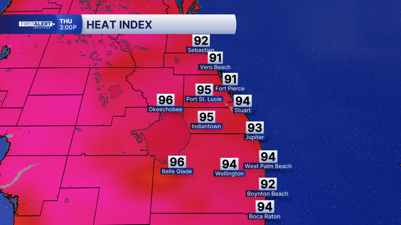
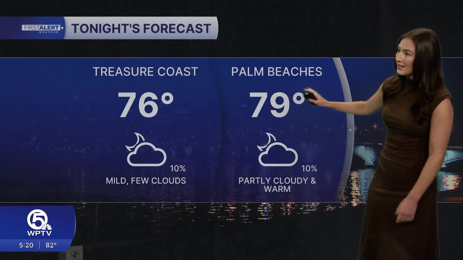
Temperatures remain warm and humid with highs in the upper 80s to lower 90s and overnight lows staying in the 70s. Heat index values will continue climbing into the 90s.
Plus, at least a moderate heat risk expected now through Friday. Beachgoers should follow all posted warning flags and swim only near lifeguards if entering the surf.


