
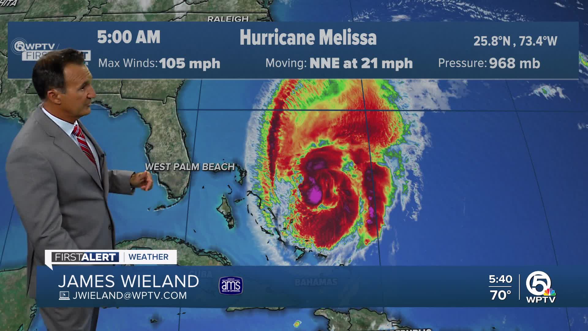


WEST PALM BEACH, Fla. — Melissa continues to pull away from the Bahamas this morning as a cat. 2 hurricane.
Hurricane Melissa is rapidly moving northeastward and is expected to bring dangerous conditions to Bermuda later today, with the storm's center forecast to pass northwest of the island territory tonight. The storm may strengthen further today before weakening again on Friday.

Tropical storm conditions will begin affecting Bermuda later today, escalating to hurricane conditions tonight. Coastal flooding from storm surge is possible in areas experiencing onshore winds.
The hurricane continues to impact multiple Caribbean regions with heavy rainfall and dangerous surf conditions.
The Southeastern Bahamas and Turks and Caicos could see an additional inch of rain, bringing storm totals up to 10 inches in the southeast Bahamas and up to 4 inches across the Turks and Caicos. Water levels should continue to subside through the morning in the southeastern Bahamas as residual flooding wanes.
Portions of Hispaniola face the possibility of 1 to 3 additional inches of rainfall this morning, with storm total accumulations potentially reaching 40 inches in southern Hispaniola.
Swells generated by Melissa will continue affecting Hispaniola, Cuba, the Bahamas and the Turks and Caicos Islands during the next couple of days. These dangerous swells will spread toward Bermuda later today, creating life-threatening surf and rip current conditions.
Residents and visitors in all affected areas should avoid coastal waters and follow all evacuation orders and safety recommendations from local authorities.

Residents and visitors in all affected areas should avoid coastal waters and follow all evacuation orders and safety recommendations from local authorities.
*Portions of this story were assisted by artificial intelligence tools and reviewed by a WPTV journalist to ensure accuracy, clarity, and adherence to editorial standards.
TRACKING THE TROPICS: Hurricane Center | Hurricane Guide


