
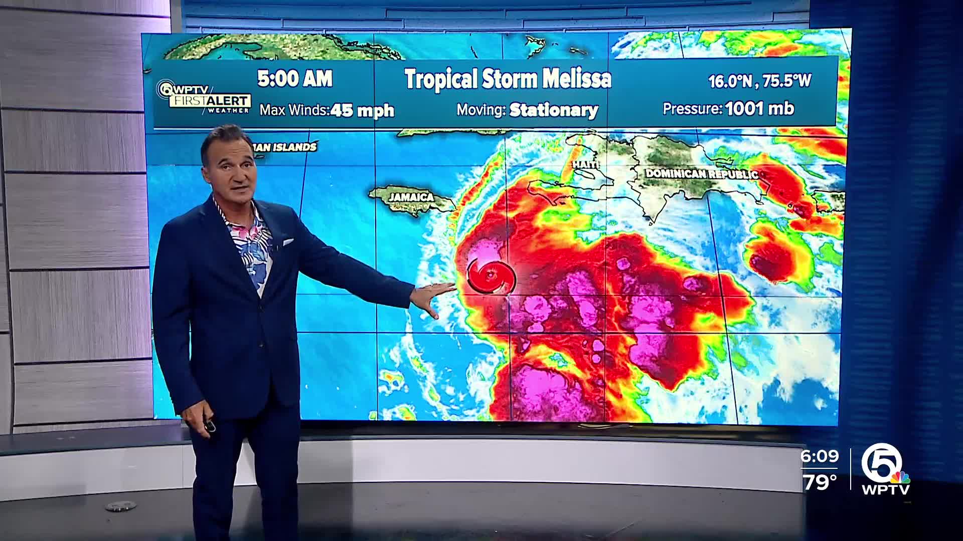


WEST PALM BEACH, Fla. — Tropical Storm Melissa is showing signs of becoming a bit more organized. However, current data indicate that the storm's structure is still not quite aligned, and its overall circulation is poorly defined.
Melissa's winds remain at 45 mph, as Melissa finds itself caught in weak steering currents, resulting in a nearly stationary system.

Despite Tropical Storm Melissa experiencing some shear, slow strengthening is anticipated in the next 24 hours. However, once the storm becomes more organized, it may rapidly intensify as it nears Jamaica, where a significant risk of heavy rainfall, damaging winds, flash flooding, landslides, and storm surge is increasing. Residents are urged to complete their preparations by Saturday to protect life and property.
In Haiti, catastrophic flooding and landslides are likely, especially in the southwestern regions, with the potential for devastating damage to infrastructure. The Dominican Republic and eastern Cuba should also stay alert as heavy rains and strong winds could pose significant risks.

Melissa will not have a direct impact on Florida. We will be watching for swells, though, as the storm moves into the Atlantic next week.
Overall, as Melissa develops, widespread impacts are expected across the Caribbean, making it crucial for everyone in its path to stay informed and prepared.
**Portions of this story were assisted by artificial intelligence tools and reviewed by a WPTV journalist to ensure accuracy, clarity, and adherence to editorial standards.
TRACKING THE TROPICS: Hurricane Center | Hurricane Guide


