
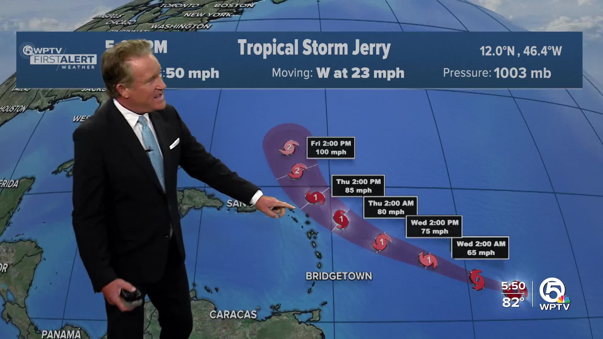


MIAMI — Tropical Storm Jerry, the 10th named storm of the Atlantic hurricane season, formed on Tuesday.
The National Hurricane Center said in its 5 p.m. update that Jerry had 50 mph winds and was located about 1,190 miles east, southeast of the northern Leeward Islands.
TRACKING THE TROPICS: Hurricane Center | Hurricane Guide
The center of the newly formed storm is moving toward the west at about 23 mph. A turn to the west-northwest is expected during the next couple of days.
On the forecast track, the NHC said the core of the system is expected to be near or to the north of the northern Leeward Islands late Thursday and Friday.
Steady strengthening is forecast, and Jerry is expected to become a hurricane in a day or two.
Tropical-storm-force winds extend outward up to 140 miles from the center.
A Tropical Storm Watch is in effect for:
* Barbuda and Anguilla
* St. Barthelemy and St. Martin
* Sint Maarten

Second System in the Gulf
Meanwhile, in the southwestern Gulf of Mexico, a separate area of low pressure near the Yucatán Peninsula is producing widespread showers and storms over parts of northern Guatemala, southeastern Mexico, and nearby waters.
This system is expected to move into the Bay of Campeche later Tuesday, and while it may slowly develop, it will likely move inland by midweek.
Regardless of whether it strengthens, heavy rain and gusty winds are expected across the Yucatán, Belize, and southern Mexico over the next few days.


