


The tropics remain active this first weekend of October, though no system poses a direct threat at this time.
A weak area of low pressure is sitting near the north-central Gulf, is slowly drifting northwest toward Texas. Strong upper-level winds should keep this disturbance from organizing into anything stronger, but it will contribute to heavy rains along the northern Gulf coast.
TRACKING THE TROPICS: Hurricane Center | Hurricane Guide
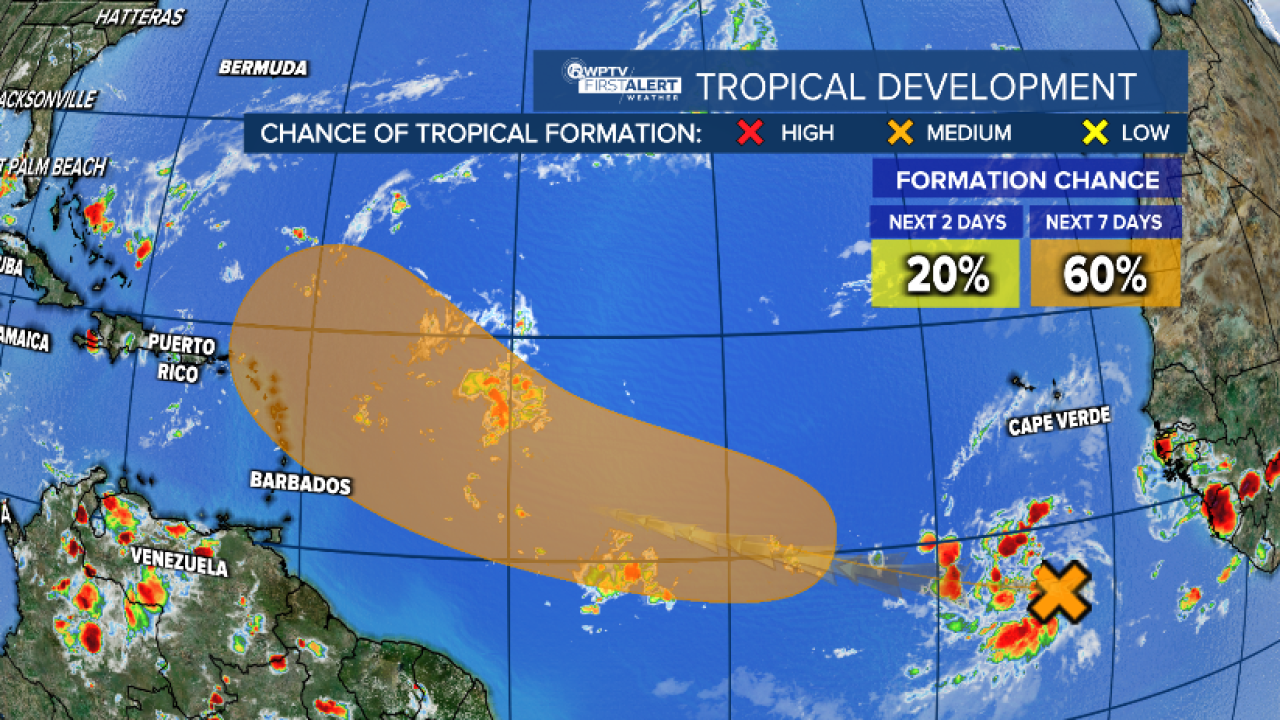
Farther east, a tropical wave near Africa is sparking a large area of disorganized showers and thunderstorms.
Conditions could gradually become more favorable for development. The NHC gives this wave a low chance of forming within the next two days, but a 60% chance of forming into a tropical depression by late next week near or east of the Lesser Antilles.
We will keep an eye on this system over the course of the next week. However, the system is expected to merge with another disturbance in the eastern Atlantic before heading west.


