


Hurricane Erin is now back to category 4 status after forming a new eyewall. The eye diameter has increased from 5-10 miles to around 45 miles.

TRACKING THE TROPICS: Hurricane Center | Hurricane Guide
Even though it has weakened since peaking with 160 mph winds on Saturday, Erin is still a major hurricane as it remains in an environment that will allow it to maintain its status as a major hurricane through the middle of the week.
Forecasters expect it to continue west-northwest path through the night before gradually turning northward by Tuesday.

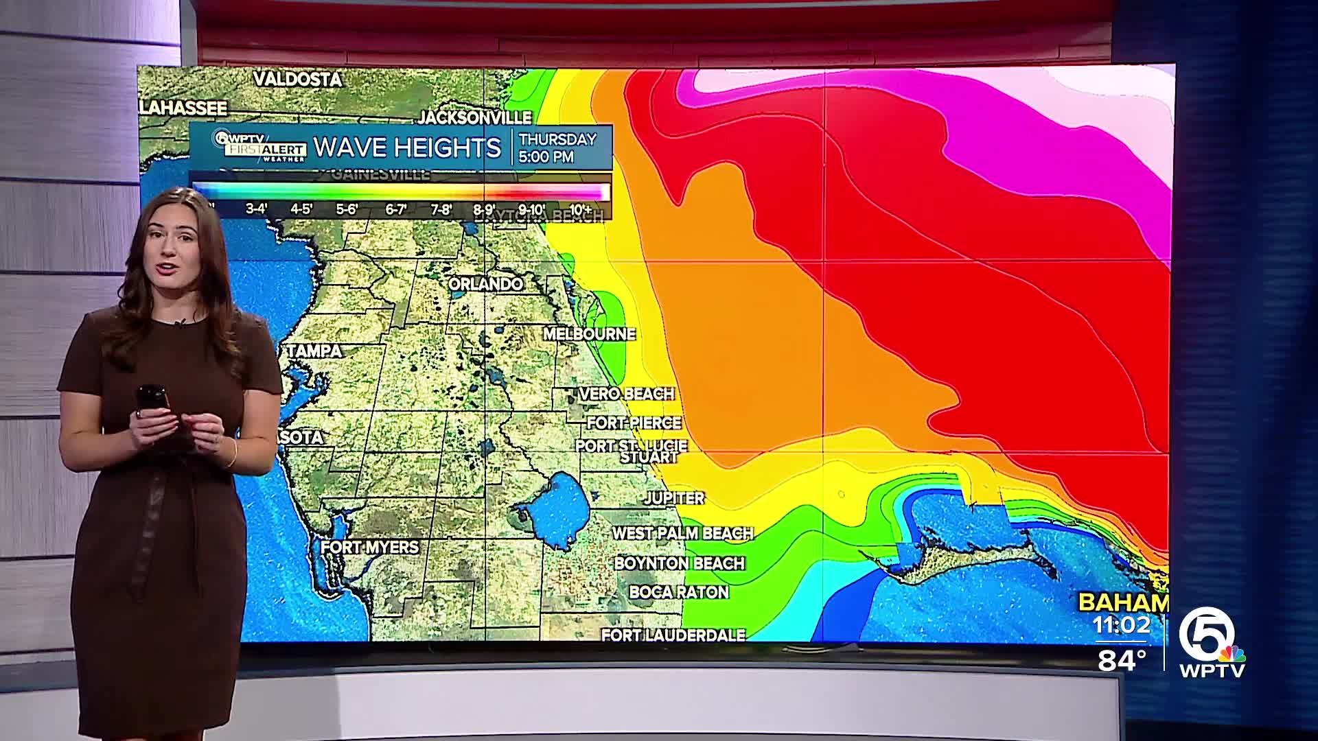
This will steer the storm away from Florida and the Southeast U.S. coastline. However, Erin’s size is expected to grow in size over the course of the next two days. That means even with the storm far offshore, it will generate dangerous surf, large swells, and strong rip currents along much of the eastern coast of the U.S.— including our coastline.
Meanwhile, heavy rain continues for parts of Puerto Rico where flooding and mudslides remain a concern. Turks and Caicos Islands and the eastern Bahamas will also experience heavy rains upwards of 2-4 inches. Bermuda is also being advised to closely monitor Erin’s progress next week as the storm grows in size.
Erin is expected to pass to the east and northeast of the Turks and Caicos Islands and the southeastern Bahamas by Monday.
Florida’s main concern is along the coast. If you’re heading to the beach, use caution and be aware of the high rip current risks.


