


Tropical activity has increased in the Atlantic Ocean as the WPTV First Alert Weather Team is tracking two named storms and one other area that has a high chance of developing.
Right now, there are no immediate concerns with Humberto, however, the other disturbance is an area that we will need to keep an eye on, as there is a chance for coastal hazards even if the system stays well east of Florida.
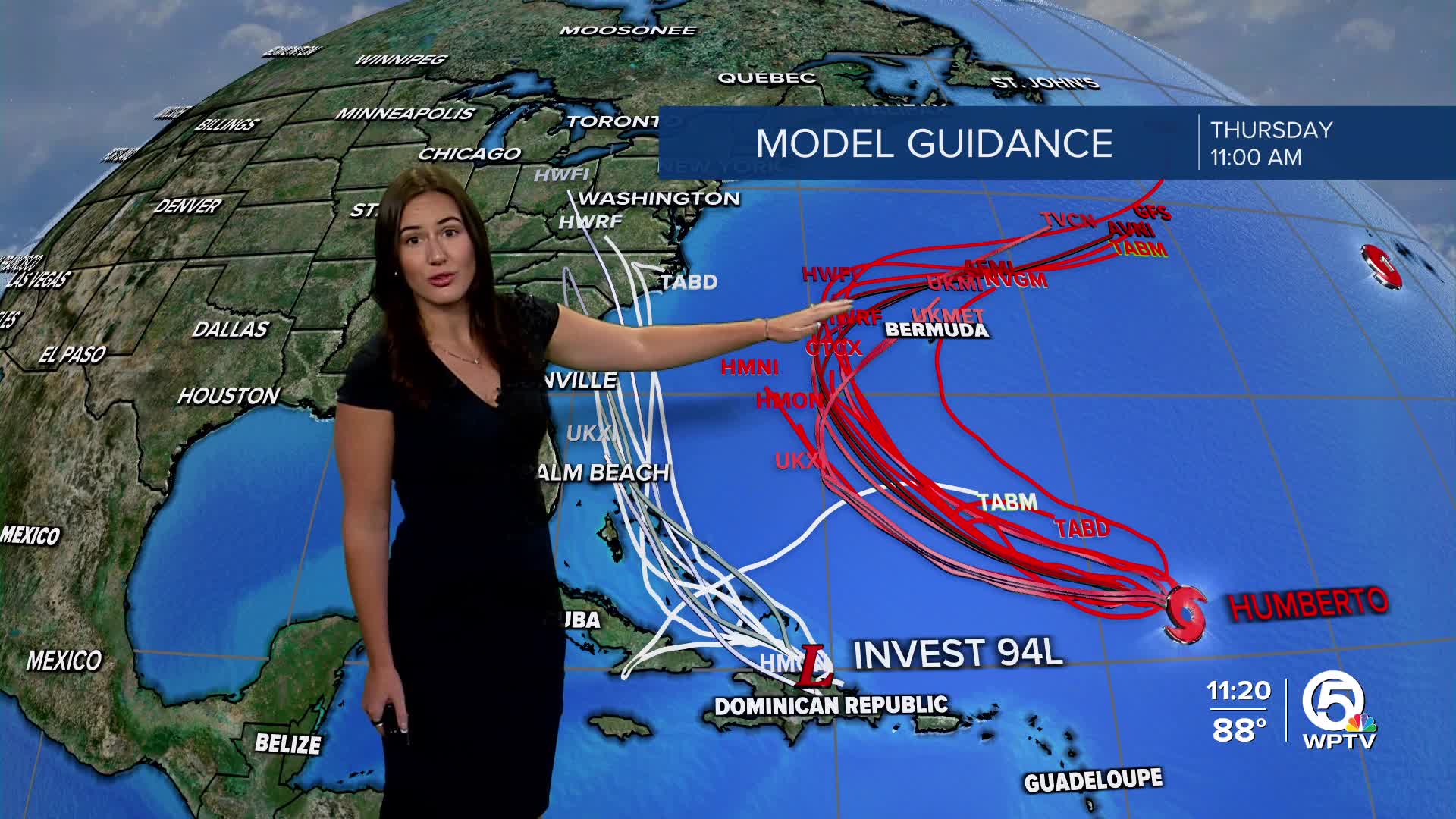
TRACKING THE TROPICS: Hurricane Center | Hurricane Guide
Humberto is moving toward the northwest at about 8 mph. It is forecast to strengthen during the next several days. Currently, it is forecast to become a major hurricane by early next week.
The track forecast becomes more complicated in the next few days due to the proximity to another tropical wave (94L) to its west and an area of high pressure.

The GFS (American) weather model shows a much faster and farther east track, while the European model predicts a slower and more westward track.
Invest 94-L
The other area we are watching, Invest 94-L, is currently over the eastern Caribbean. It's producing widespread disorganized showers, storms, and gusty winds across Puerto Rico and the Virgin Islands, with conditions spreading into the Dominican Republic Thursday night.

There's a high chance this system will develop on Friday or into the weekend near the Bahamas, where conditions are more favorable.
The Dominican Republic, Haiti, the Turks and Caicos Islands, and the Bahamas should monitor the progress of this system. Regardless of development, heavy rains and gusty winds are likely across that region during the next couple of days.
The next name on the list is Imelda.
Hurricane Gabrielle
In addition to the newly formed storm, the National Hurricane Center is monitoring Hurricane Gabrielle and one other area for potential development. Gabrielle is still a dangerous hurricane churning in the subtropical Atlantic waters.
A hurricane warning has been issued for the Azores, where hurricane conditions are expected as it passes near or over the islands late Thursday or early Friday. Storm surge will remain a large concern with coastal flooding.
Swells are still reaching the U.S. as the powerful hurricane is generating life-threatening surf and rip currents for the Atlantic coast, north of North Carolina.


