


WEST PALM BEACH, Fla. — A cold front has passed through the area, ushering in colder air behind it.
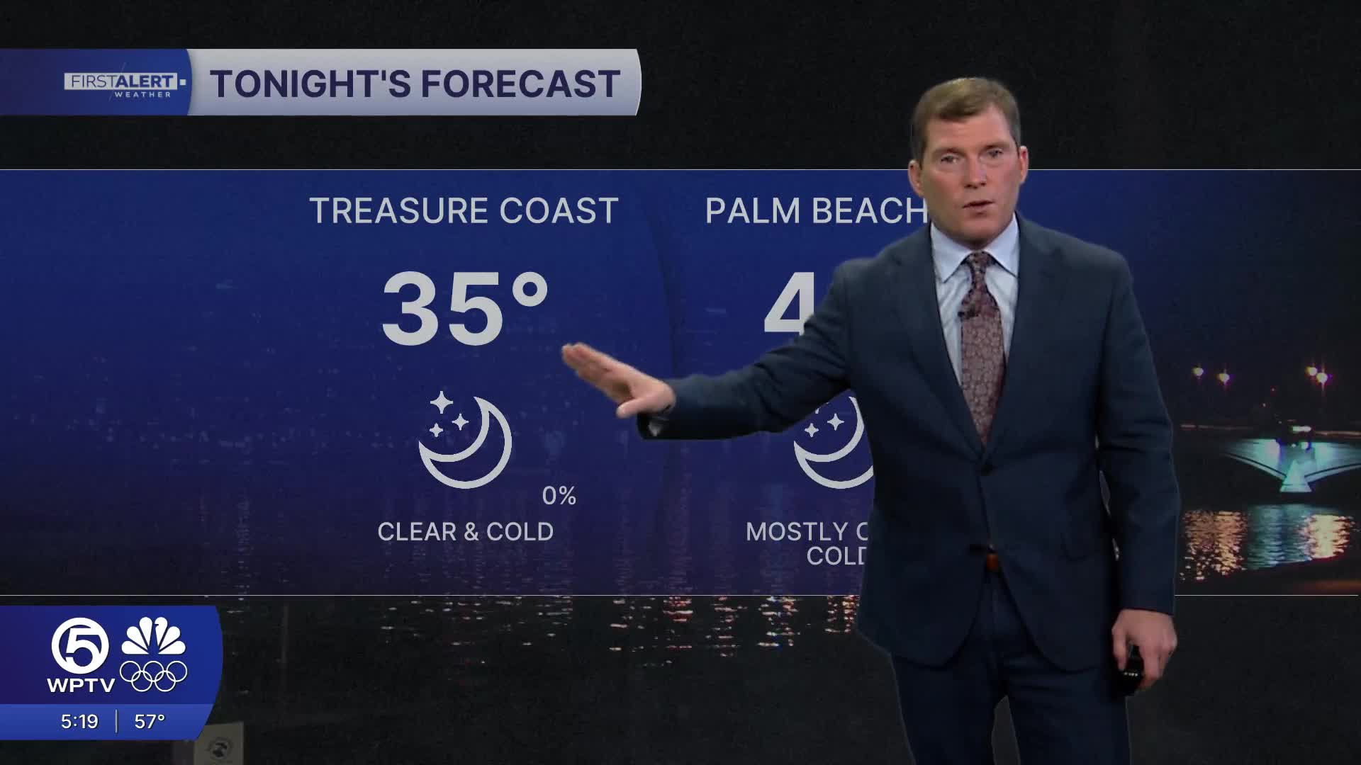
Temperatures will drop sharply Thursday night, with overnight lows falling into the mid 30s further inland. Coastal communities are more likely to remain in the lower 40s. With breezy conditions continuing overnight, it will feel even colder, with wind chills near freezing early Friday morning.
A Cold Weather Advisory is in effect from tonight to 9 a.m. Friday for inland portions of South Florida, including inland areas of the Treasure Coast and western Palm Beach County. Residents should plan for a cold start to Friday morning, dress in layers, bring pets indoors, and protect sensitive plants.
MORE WEATHER: Radar | Alerts | 7-Day Forecast | Hourly Forecast
Friday will remain cooler than normal despite plenty of sunshine, with afternoon highs only reaching the low to mid 60s. Winds will gradually ease during the day, but the cool air will linger into Friday night, when temperatures once again fall into the 40s across much of the area.
Conditions improve heading into the weekend. High pressure builds in, bringing dry weather and a gradual warming trend. Highs will climb back into the upper 60s and low 70s over the weekend, with overnight lows mainly in the 40s and 50s. By early next week, temperatures rebound further, with highs returning to the upper 70s.
Beach and boating conditions will be hazardous through at least Friday. A high risk of rip currents is in place for Palm Beach County beaches due to increasing winds and lingering swell. Boaters should use extreme caution, as Small Craft Advisories are in effect with strong winds and seas building to 6 to 10 feet offshore.


