


WEST PALM BEACH, Fla. — Tonight will be calm and mild, with lows falling into the 50s and low 60s, and patchy fog could redevelop late tonight into early Monday morning.
MORE WEATHER: Radar | Alerts | 7-Day Forecast | Hourly Forecast
Monday stays sunny and warm. One last taste of near 80° weather, before a strong cold front sweeps through late Monday night into early Tuesday. It will get breezy starting late in the day and heading into Tuesday.
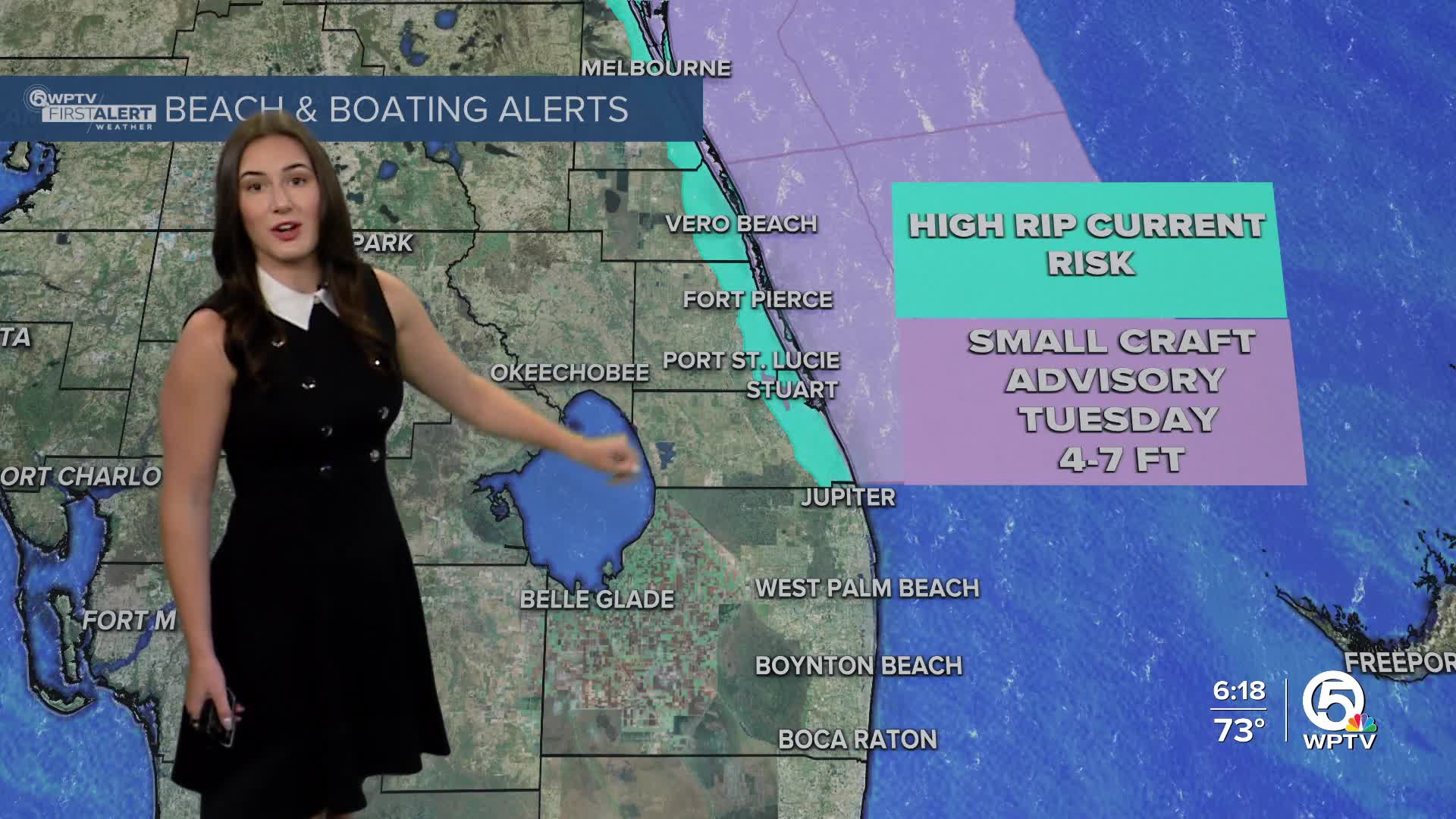
A moderate to high rip current risk continues at Atlantic beaches due to increasing swell. Swimming is discouraged, especially near piers and jetties on Monday. Boating will be a little bumpy too with seas increasing as we head into Tuesday.
With northwesterly winds picking up offshore, a Small Craft Advisory will go into effect on Tuesday.
The front will usher in much cooler, drier air to start the new year, with overnight lows tumbling into the 30s across interior areas, while coastal communities hold in the lower 40s.

The coldest mornings are expected Wednesday and Thursday, with some inland locations feeling even colder due to a light breeze.
Daytime temperatures will struggle to warm up, with highs only in the upper 60s on Wednesday and Thursday. Gradual warming is expected by the end of the week.


