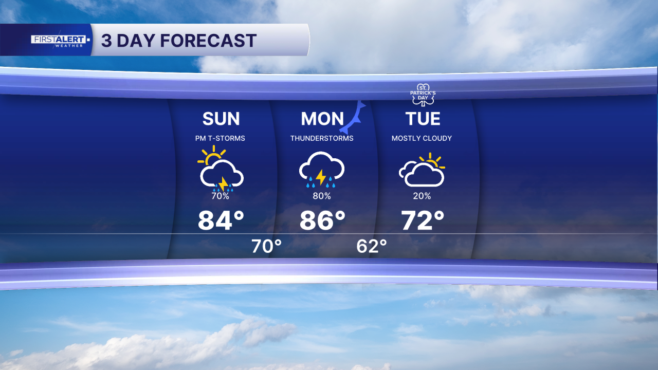


WEST PALM BEACH, Fla. — Unsettled weather continues for the area with increasing chances for showers and thunderstorms across the Treasure Coast and Palm Beaches through Monday.
Overnight through Sunday morning will be partly to mostly cloudy with lower rain chances. Storm coverage increases on Sunday afternoon as additional unstable weather moves over Florida. Highs will reach the lower 80s.
MORE WEATHER: Radar | Alerts | 7-Day Forecast | Hourly Forecast
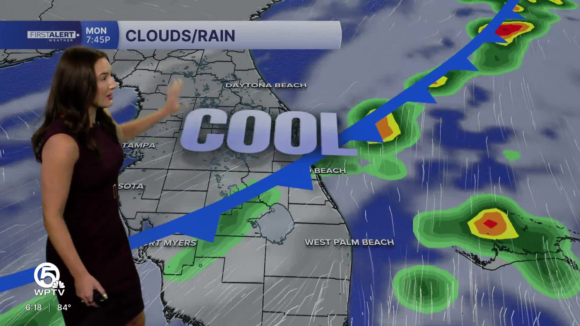
Numerous showers and thunderstorms are expected, especially during the afternoon and evening hours. Some storms may become strong, producing wind gusts up to around 60 mph and hail up to about the size of a quarter. Localized flooding is also possible in areas that see repeated rounds of heavy rain.

Another round of storms is expected Monday as a strong late-winter cold front approaches Florida. The atmosphere will remain warm and unstable ahead of the front, allowing storms to develop again during the afternoon and evening. Isolated strong storms could produce strong wind gusts and small hail.
Behind the cold front, a noticeable cooldown arrives for the middle of next week. Temperatures will drop significantly compared to the weekend, with highs expected to stay in the low 70s by Tuesday and overnight lows potentially dipping into the 50s across parts of the region.