
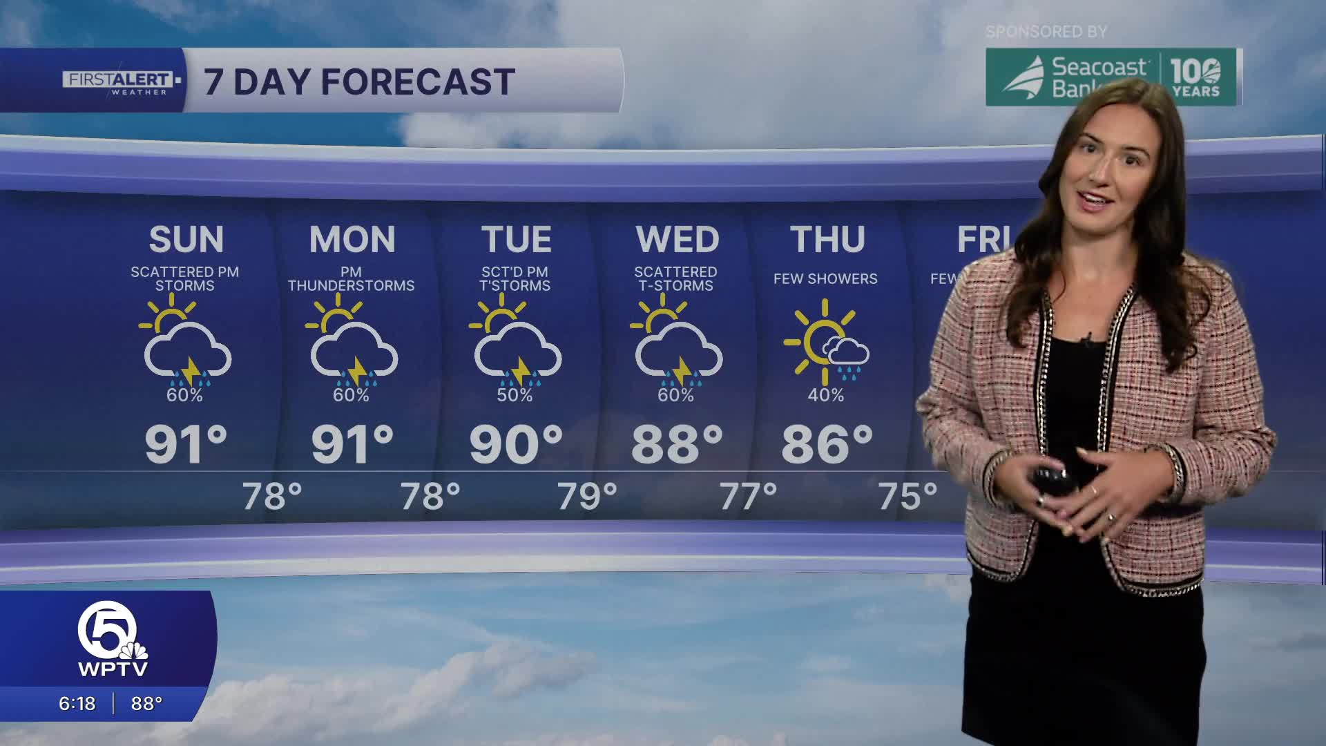


WEST PALM BEACH, Fla. — Tropical moisture is moving across the state as winds turn more west and northwest. This increases the chance for multiple rounds of rainfall on Sunday.
MORE WEATHER: Radar | Alerts | 7-Day Forecast | Hourly Forecast
The morning will once again be mostly cloudy. Even with the lack of sunshine, you can expect a warm and humid day with highs near 90 degrees and feels-like temperatures pushing 100.
Showers and thunderstorms look to fire up around 2PM and continue to drape across the area in the late afternoon. Rain/t-storm chances continue through much of the evening.
Any thunderstorms that develop, will be capable of producing very heavy rainfall in a short period of time. Watch out for ponding on the roads and turn around.
The weather pattern of dry mornings followed by a wet second-half of the day continues through the first half of the week before a cold front arrives. Even if the front doesn't pass completely through the area, it will still shift our winds to come out of the north and bring us some relief from the heat, humidity, and rain.

The latest models have slightly cooler and less humid air arriving on Thursday with highs in the mid 80s. Some inland spots may even dip into the 60s overnight.


