


WEST PALM BEACH, Fla. — We continue to transition toward a more typical summertime weather pattern this weekend with warm temperatures, increasing humidity, and the chance for afternoon storms.
It will stay mainly clear near the coast through most of the evening. After midnight, showers could develop near the coast. It will feel a bit muggy overnight with temperatures falling into the mid-upper 70s along the coast and lower 70s further inland.
MORE WEATHER: Radar | Alerts | 7-Day Forecast | Hourly Forecast

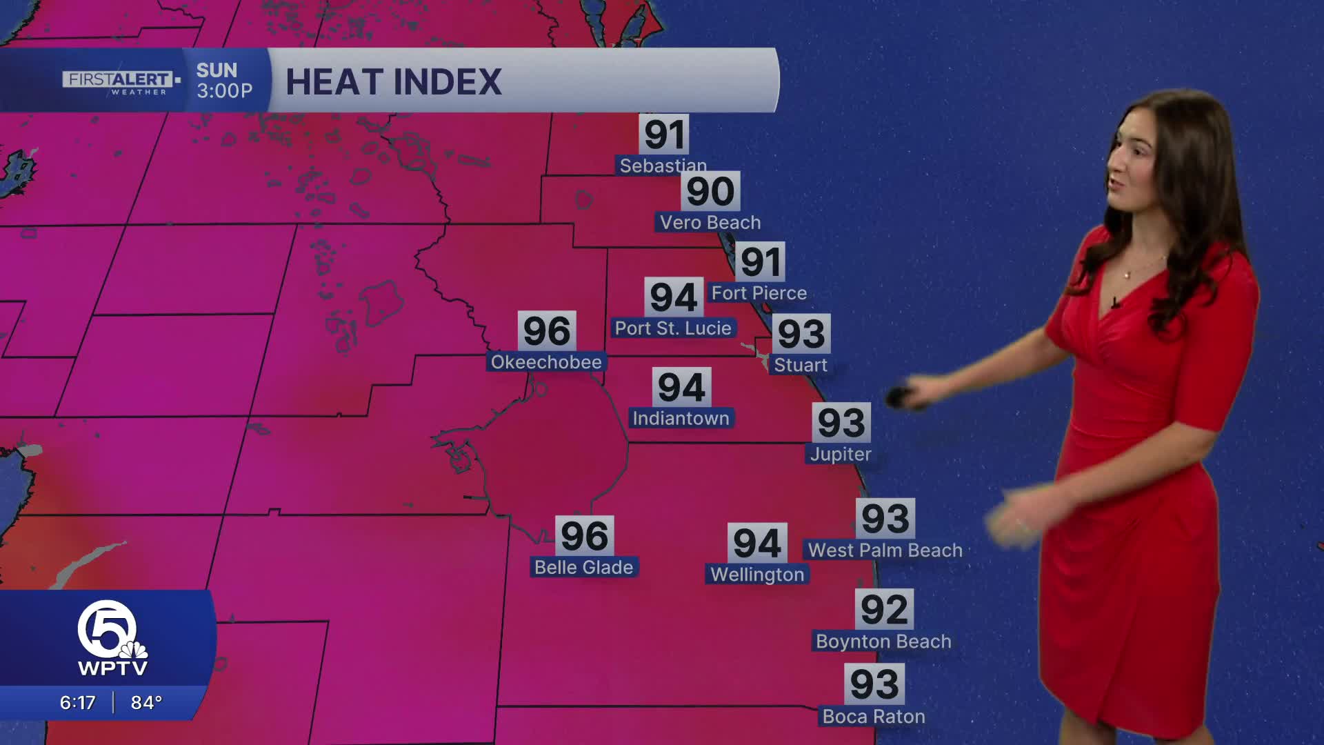
The forecast looks great near the coast tomorrow. However, it will be hot and humid with highs reaching the mid-upper 80s. Feels-like temperatures will approach the mid 90s. Make sure you are staying hydrated even if you aren't spending a lot of time outside. The easterly breeze will give some relief from the heat with winds around 10mph plus higher gusts.
The onshore winds increases the rip current risk along the coast. Beachgoers should be aware of the high rip current risk along the coast. Always swim by a lifeguard and swim parallel to the shore get out of a rip current.
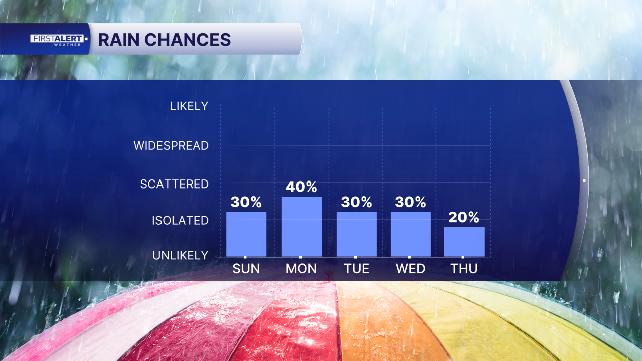
There is a threat of showers and thunderstorms in the afternoon as our sea breeze pushes inland, starting up around noon. Most of the heavy rainfall will be on the west coast of Florida, but with the two sea breezes colliding, heavy downpours and thunderstorms are possible around Lake O and western Palm Beach County.
Scattered storms will once again be possible on Monday, as our weather pattern continues to be influenced by high pressure in the Atlantic. This allows for the sea breeze to move onshore and trigger storms. The high will gradually move further east throughout the week, weakening its influence. It will still remain hot and humid through next week with highs in the upper 80s.