


WEST PALM BEACH, Fla. — It’s a warm and humid fall weekend across South Florida, but big changes are on the way.
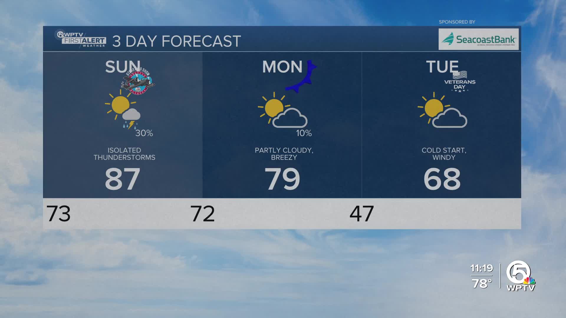
After highs in the upper 80s through Sunday, a strong cold front will sweep across the state early Monday. Behind it, temperatures will drop sharply, bringing the coldest air we’ve seen so far this season.
MORE WEATHER: Radar | Alerts | 7-Day Forecast | Hourly Forecast
Before the front arrives, daytime heating and a weak sea breeze could spark a few spotty showers or storms on Sunday afternoon.
Any storms that form could produce brief gusty winds and lightning. The Storm Prediction Center has placed parts of east central Florida, including Sebastian and areas north, under a Marginal Risk (1 out of 5) for isolated strong storms.
A noticeable change arrives Monday in the Treasure Coast sweeping southward. Winds turn out of the north behind the front, picking up to 10–15 mph with higher gusts. Highs will tumble into the 60s and low 70s, which is nearly 15 degrees cooler than Sunday.

By Monday night into Tuesday morning, temperatures are forecast to drop into the 40s. Inland spots could even dip into the upper 30s, while coastal areas may stay closer to 50. Wind chills could make it feel like the upper 30s to lower 40s early Tuesday morning.
Afternoon highs on Veterans Day will only reach the mid to upper 60s, with breezy north winds keeping it feeling cool all day.
The cold, dry air settles in through midweek before a gradual warm-up begins. Highs return to the 70s by Wednesday and could reach the low 80s again by the end of the week.
Boating conditions will deteriorate quickly Monday behind the front, with winds increasing to 20–30 knots and seas building to 5-7 feet. A high surf and small craft advisory will likely be needed. A moderate risk of rip currents continues for Palm Beach County beaches this weekend and will likely increase next week as onshore winds strengthen.


