


WEST PALM BEACH, Fla. — After a soggy week across much of the area, we are finally transitioning into a drier weather pattern.
Overnight, a shower or thunderstorm can't be ruled out. It will be partly cloudy with most spots falling into the lower 70s. Some spots inland and in the Treasure Coast may briefly dip below 70.

On Sunday, storm coverage begins to decrease as a weak frontal boundary slides south into the Keys and drier air filters into Central Florida.
It will be a partly sunny day and slightly less humid. A few showers and storms will still be possible in the afternoon, but not as widespread or intense as in recent days.
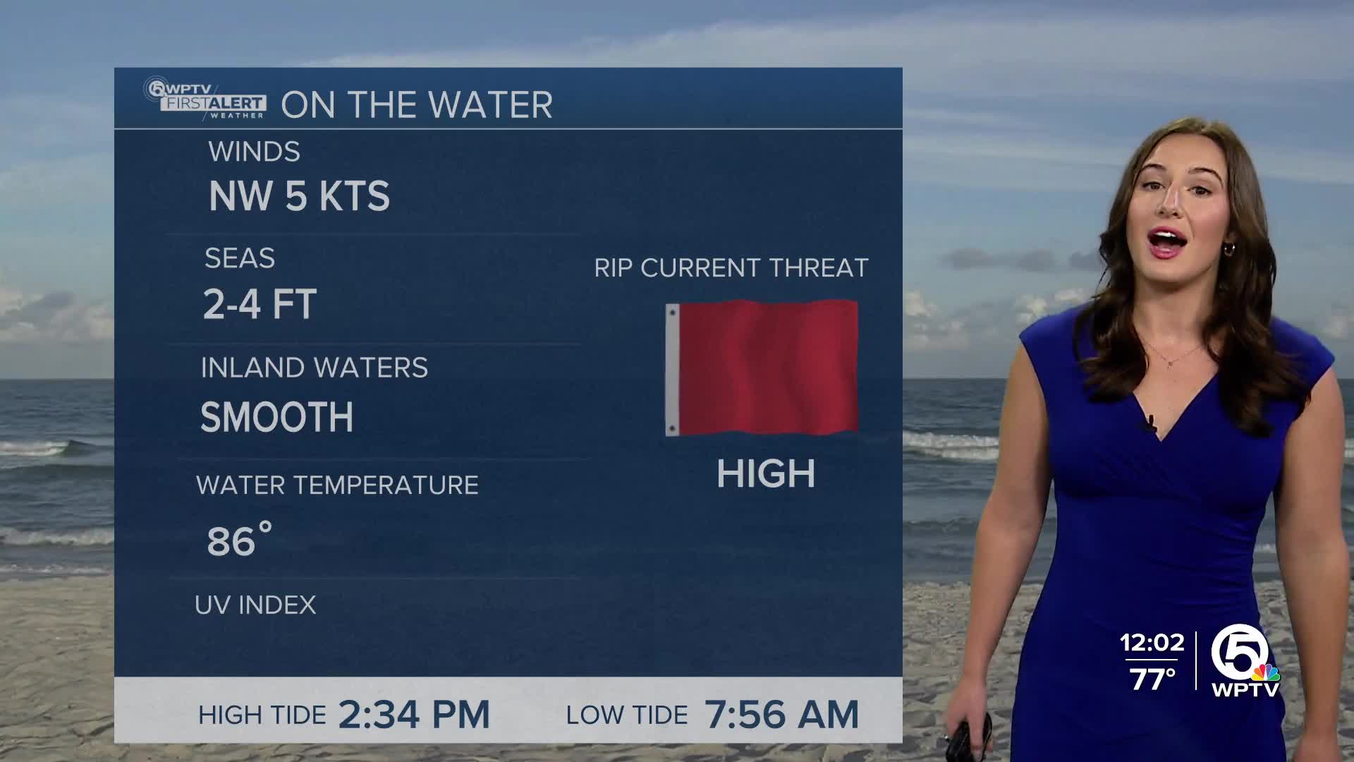
Highs will climb into the upper 80s with a light breeze. If you are planning on heading to the beach, be careful in the water as the risk of rip currents remains high.
MORE WEATHER: Radar | Alerts | 7-Day Forecast | Hourly Forecast
High pressure remains to our north, keeping rain chances lower Monday and Tuesday, especially across Central Florida, before moisture increases again by mid to late week.
By the middle half of the week, shower and storm chances rise back into the forecast as a front that is currently stalled south of Florida, will inch its way closer to Florida. Winds shift onshore and deeper tropical moisture returns. Temperatures through the week will generally stay in the mid to upper 80s for highs and the mid 70s for lows.


