


WEST PALM BEACH, Fla. — Clouds will stick around overnight with the chance for additional coastal showers and rumbles of thunder. Lows will fall into the mid 70s across the area.
MORE WEATHER: Radar | Alerts | 7-Day Forecast | Hourly Forecast
We have more rain in store for us on Sunday!
A few showers will move along the coast in the morning. Scattered storms will pop-up inland and will try to push back towards the coast in the evening. Highs stay in the upper 80s, with some spots hitting 90.
The rainy pattern looks to subside next week as the frontal boundary finally breaks down. Highs will slowly creep towards the mid 90s by the middle of the week.
The first day of school starts off dry in the morning, but spotty storms will develop around bus time. Highs will be in the lower 90s.
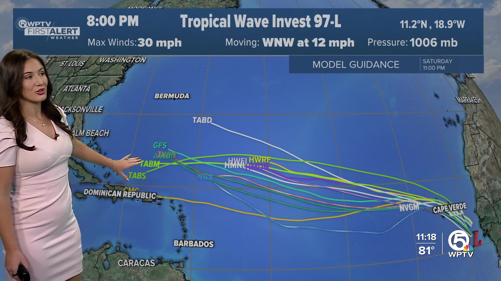
TROPICS:
As for the Atlantic basin, we still have a lot of the Hurricane season to go! There is a wave that is moving off the coast of West Africa. Models are in fairly decent agreement that it has potential to develop and have more tropical characteristics when it makes its way to the central Atlantic Ocean.
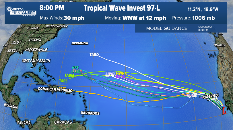
Longer range models are in agreement that we could have our next named storm, Erin, by later next week.
The EURO and GFS keep it off our coast in the long range models, but it is still too soon to navigate and assess the strength. Stay with WPTV for the latest updates!
The other area highlighted in yellow has a low chance of developing in the next week, but is not expected to impact land.


