


WEST PALM BEACH, Fla. — A few isolated showers or thunderstorms are possible through the early morning hours, especially near the coast. Lows will fall into the mid-upper 70s.
MORE WEATHER: Radar | Alerts | 7-Day Forecast | Hourly Forecast
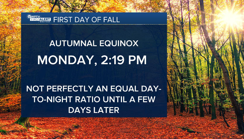
As we head into the first day of fall, scattered showers and thunderstorms return. The autumnal equinox takes place at 2:19 p.m. as the sun shines directly over the equator.
The best chance for storms on Monday will be across the interior and southwest portions of the state, but a few will also develop closer to the east coast, especially during the afternoon.
Temperatures will stay near normal with highs close to 90 degrees, though it will feel hotter, with heat index values approaching the triple digits. By mid to late week, high pressure will build back across the region and rain chances will dip by Friday.
Towards next weekend, a nearby front could bring back higher moisture levels with a better chance of showers and storms.
On the water, long-period swells moving in from the Atlantic will keep the risk of rip currents high along the Treasure Coast beaches at least through Monday. Seas will run two to three feet in the Atlantic and small craft should exercise caution near inlets.


