


WEST PALM BEACH, Fla. — Temperatures this morning broke many records across the state, including Fort Pierce that shattered an over 100-year-old record.

The cold pattern continues Sunday night into Monday morning.
While winds will be lighter, clear skies will allow temperatures to fall quickly, increasing the risk of frost and freeze codnitions which could kill crops, other sensitive vegetation and possibly damage unprotected outdoor plumbing.
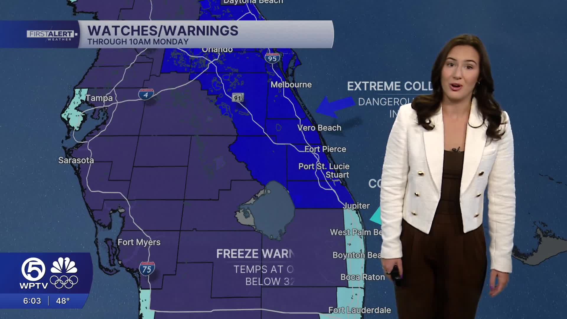
Another Freeze Warning has been issued for our entire region with freezing temperatures likely and a hard freeze for inland spots and in the Treasure Coast. An Extreme Cold Warning has been issued for the Treasure Coast and Okeechobee County, with a hard freeze expected once again.
Temperatures are forecast to fall into the upper 20s and lower 30s. Wind chill will make it feel like the teens to lower 20s.
MORE WEATHER: Radar | Alerts | 7-Day Forecast | Hourly Forecast
Gradual warming begins Monday afternoon, but frost and freezing temperatures remain possible into Tuesday, particularly for the inland areas. We will have plenty of sunshine in the afternoon along with highs in the upper 50s.
Midweek will be warmer with temperatures rebounding into the lower 70s. However, another cold front arrives on Thursday with scattered showers and chillier air Friday morning. The good news is that we aren't expecting freezing air with this front and the following weekend looks beautiful.


