
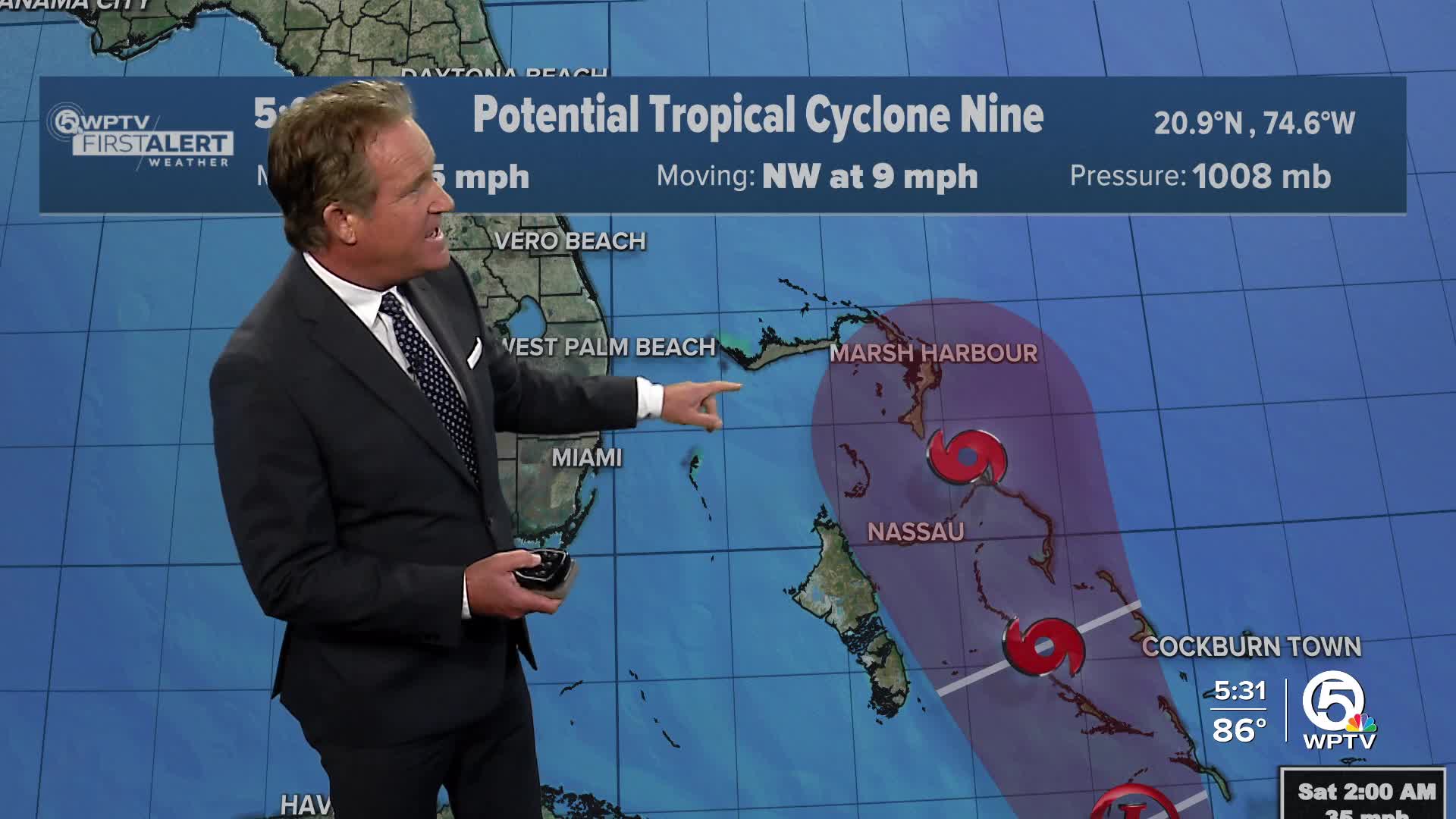


A tropical wave, now called Potential Tropical Cyclone Nine, is located near Hispaniola and the Turks and Caicos, and continues to show signs of strengthening. It is forecast to become Tropical Storm Imelda by this weekend.
The system is moving toward the southeastern Bahamas, with a good chance that it will become a tropical depression soon.
Whether it develops or not, the system is already bringing heavy rain and gusty winds to parts of the Dominican Republic, Haiti and the Turks and Caicos, and that weather will likely spread to the Bahamas and eastern Cuba soon.
TRACKING THE TROPICS: Hurricane Center | Hurricane Guide

There’s still some uncertainty on its path and strength, but the risk of wind, rain, and coastal impacts along parts of the Southeast U.S. near Georgia and the Carolinas is growing. Residents in those areas should keep an eye on this system.
Locally, we will be watching for swells generated from the potential storm. These swells look to reach us late Sunday into Monday.

Humberto is now a Category 3 hurricane with winds now up to 115 mph.
Satellite images show the storm becoming more organized, with tall, cold cloud tops and active thunderstorms mainly on its eastern side. It's moving slowly right now due to weak steering winds, but it’s expected to pick up speed and head northwest, eventually turning north by the weekend.

Conditions around Humberto are very favorable for rapid strengthening — warm ocean waters, moist air, and light wind shear. Because of that, expect it to intensify significantly over the next few days, possibly reaching major hurricane status by the weekend. Humberto will stay well east of us (~800miles) and not impact our weather, but we will have coastal impacts with large swells in combination with Imelda next week.


