
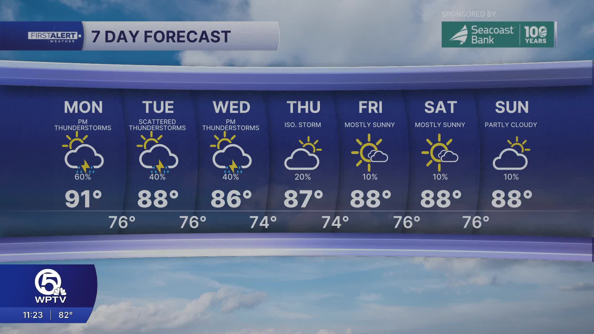


WEST PALM BEACH, Fla. — More unsettled weather moves in on Monday with scattered to widespread storm activity.
MORE WEATHER: Radar | Alerts | 7-Day Forecast | Hourly Forecast
Monday starts off partly sunny and muggy. With lots of moisture sticking around, highs remain above normal through Monday with peak heat indices in the mid 90s to low 100s. The excess moisture will help fuel thunderstorms Monday afternoon/evening. Strong-severe storms could develop with the main threats of frequent lightning, wind gusts (40-60 mph), coin-sized hail, and torrential downpours.

An approaching 'cool' front moves into South Florida Tuesday with more showers and thunderstorms. Storms will linger through Wednesday before the front finally clears out.
Temperatures briefly become more seasonable behind the front with lower rain chances as slightly drier air moves in through the rest of the week.


