


Heat advisory for Palm Beach County from 11 a.m. to 6 p.m. on Tuesday. The heat advisory criteria for Palm Beach County is 108 degrees for two consecutive hours for Palm Beach County, according to the National Weather Service.
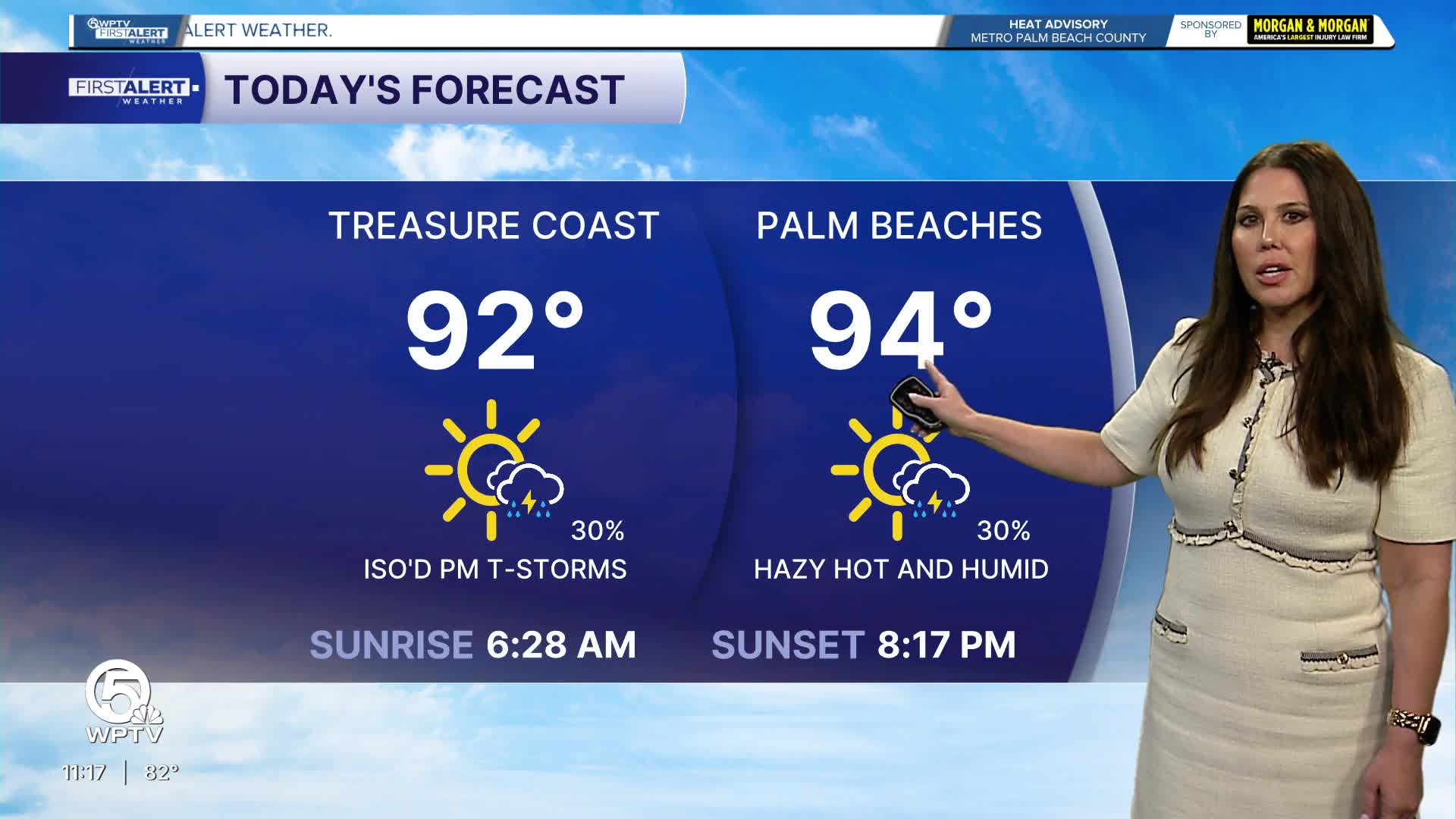
Hot, humid summer weather remains firmly in place across the Palm Beaches and Treasure Coast through the next several days.
MORE WEATHER: Radar | Alerts | 7-Day Forecast | Hourly Forecast
Afternoon temperatures will reach the upper 80s to lower 90s along the coast and the lower to middle 90s inland.
When combined with the tropical humidity, heat index values will frequently climb into the 100- to 109-degree range during the afternoon hours.
Today will feature a mix of sunshine and clouds. Sea breeze boundaries will help spark scattered afternoon and early evening thunderstorms, with the greatest coverage expected inland and west of Interstate 95.
Coastal communities will see fewer storms, but a few cells may drift toward the coast late in the day. Any thunderstorm could produce brief heavy downpours, gusty winds, and frequent lightning.
Wednesday and Thursday will follow a similar pattern. Morning sunshine will give way to building clouds, followed by scattered afternoon thunderstorms. Storm coverage should be highest across interior Palm Beach County and western portions of the Treasure Coast, while beaches see a lower but still present chance of rain.
Temperatures will remain near 90 degrees along the coast and in the lower 90s inland, with oppressive humidity continuing.
Looking ahead toward the end of the week, the summertime pattern persists with hot mornings, steamy afternoons, and scattered thunderstorms developing during the heat of the day.
Localized heavy rainfall is possible where storms repeatedly develop, but many neighborhoods will receive little or no rain while others see brief tropical downpours.
**Portions of this story were assisted by artificial intelligence tools and reviewed by a WPTV journalists to ensure accuracy, clarity, and adherence to editorial standards.


