


WEST PALM BEACH, Fla. — It's been a windy day leading up to a cold front that will move through the area overnight.
While a stray, passing shower is possible this evening, the leading edge of the front won't reach our area until after midnight.
MORE WEATHER: Radar | Alerts | 7-Day Forecast | Hourly Forecast
The line of strong storms is expected to break up before reaching us. Rain will be scattered with the possibility for a few thunderstorms will start to move in the Treasure Coast and Okeechobee County during the early morning hours. The soil will soak up the rain fast, so roads and sidewalks may even be dry before you even head out the door in the morning.
By the time the front gets to Palm Beach County, around dawn, the rain will be spotty.
While any rainfall is welcome, totals are expected to stay under a quarter inch for most areas — not enough to significantly improve the ongoing drought.
As we head into the late morning hours on Presidents' Day, clouds will clear north to south.
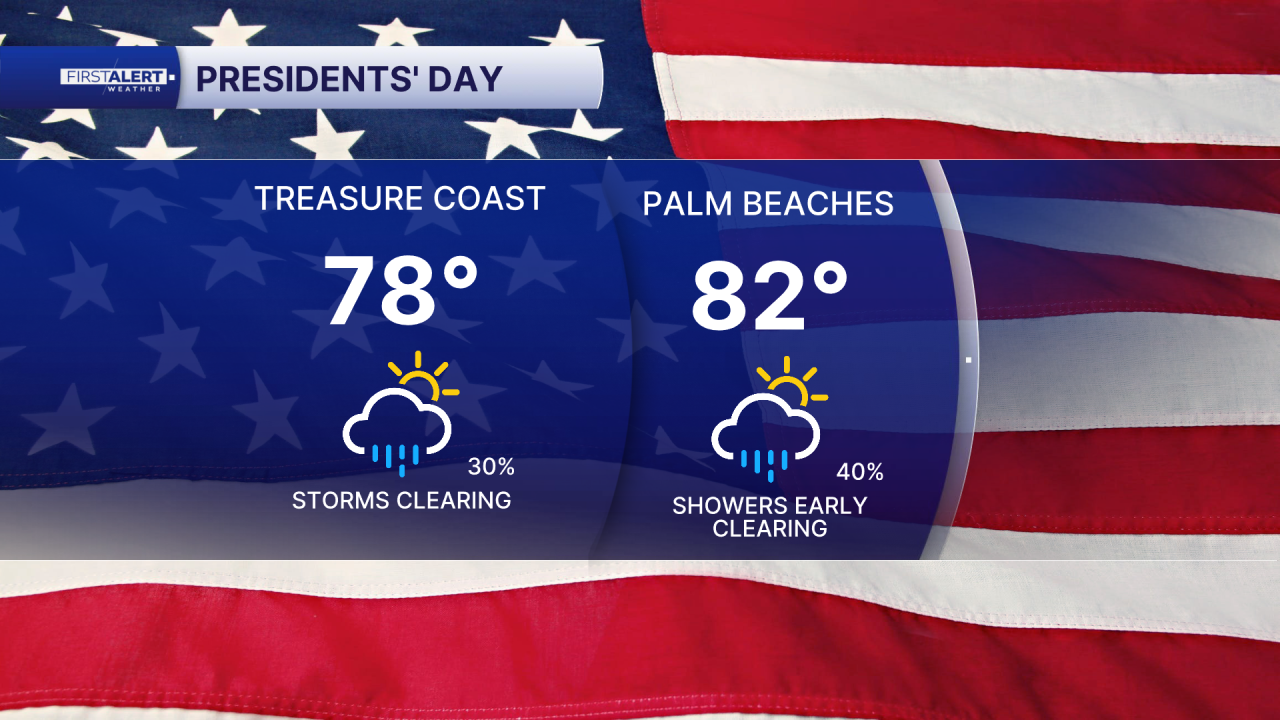
While not as windy as Sunday, it will still be a breezy day as winds swing to come out of the north. Highs will reach the mid 70s for the Treasure Coast and around 80 for the Palm Beaches.
The front isn't bringing much of a cooldown to the area, but it will be less humid.
Tuesday and Wednesday will be mainly sunny with a small chance for a stray, coastal shower. The rest of the week will be sunny and warm with highs warming into the mid 80s— not quite record levels, but several degrees above normal for February.


