
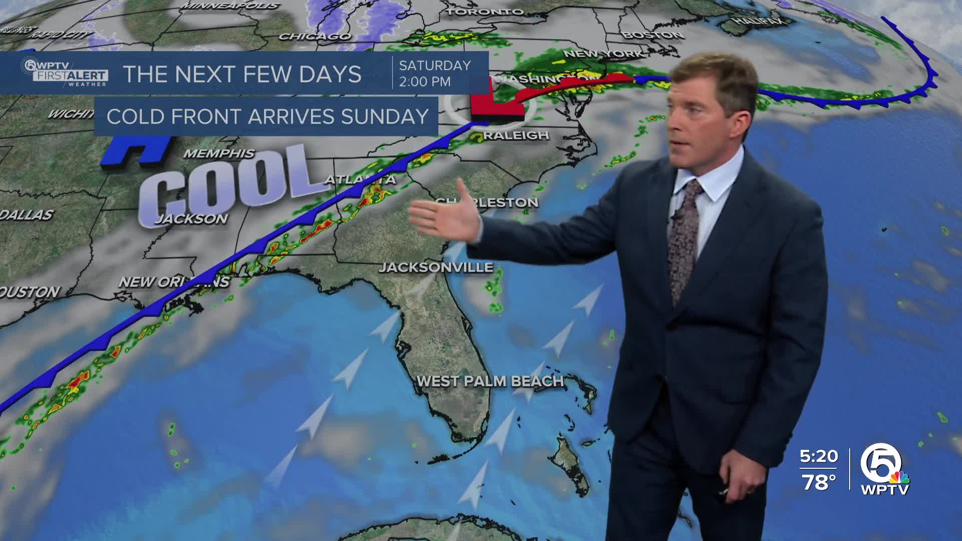


WEST PALM BEACH, Fla. — Under the lingering influence of a strong area of high pressure, South Florida is heading into the weekend mostly dry and warm. As the high shifts east, there may be a few isolated showers, otherwise you can expect mostly sunny afternoons and warm, humid temperatures.
Afternoon highs will reach the low to mid-80s through the weekend, while overnight lows dip into the mid-upper-60s along the East Coast. Weather impacts should stay fairly minimal through Saturday, with dry conditions and warm afternoons sticking around.
MORE WEATHER: Radar | Alerts | 7-Day Forecast | Hourly Forecast

Changes arrive late Sunday into Monday as a cold front approaches from the north. This front will bring increasing cloud cover, a small chance for rain with some rumbles of thunder—mainly along the East Coast and over nearby Atlantic waters.
After the front passes, cooler air settles in, with daytime highs dropping into the low 70s on Monday and nighttime lows falling into the 50s inland and northern spots on the Treasure Coast. Lingering moisture could keep slight rain chances around through at least midweek, along with cooler, cloudier conditions.

With the moisture sticking around and an approaching cold front, we could get a well-needed soaking rain on Thursday. This will bring temps down significantly Friday and finally clear us out.
**Portions of this story were assisted by artificial intelligence tools and reviewed by a WPTV journalists to ensure accuracy, clarity, and adherence to editorial standards.


