
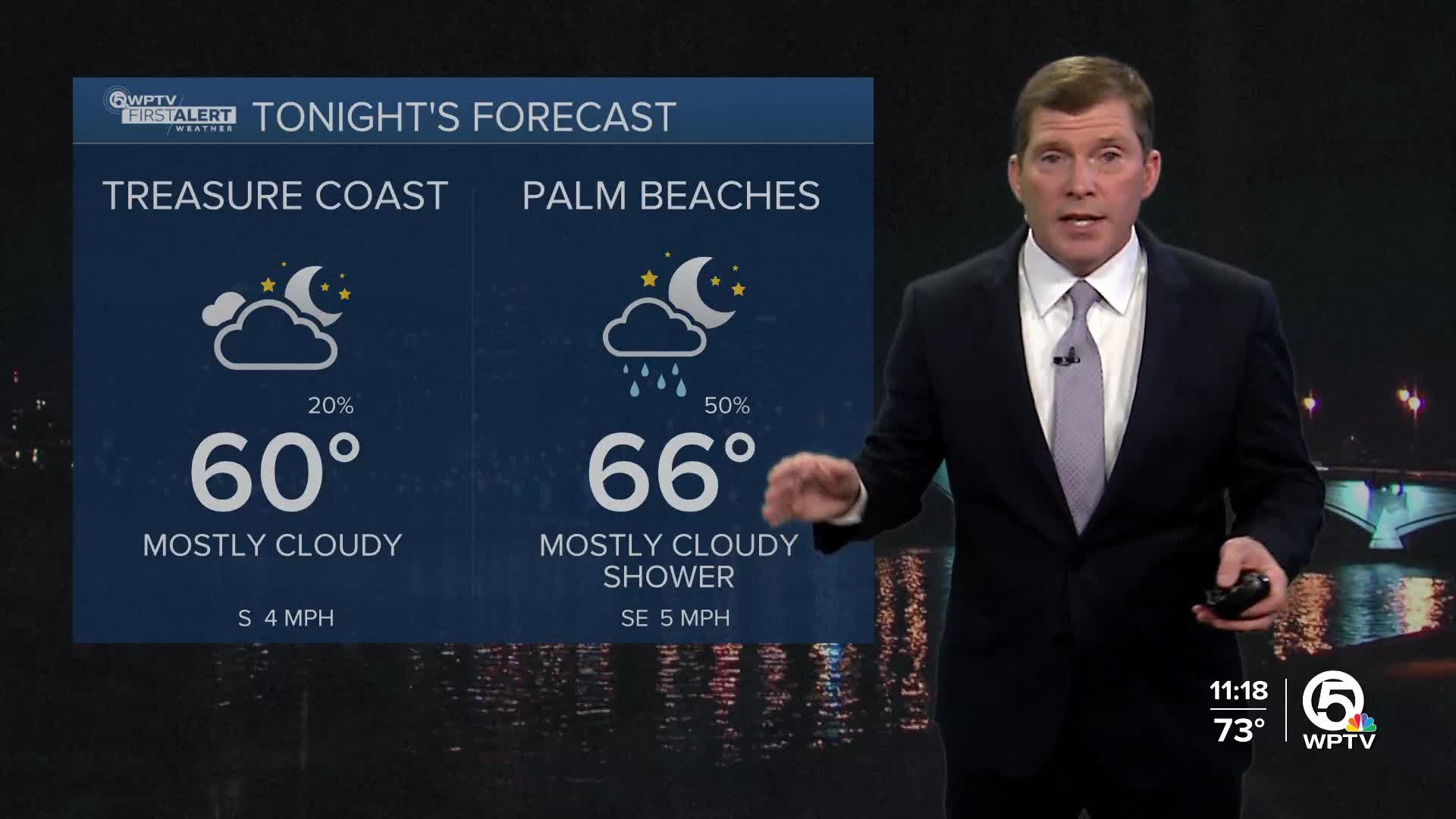


WEST PALM BEACH, Fla. — A stalled frontal boundary is causing dreary conditions to continue this evening throughout Palm Beach and Martin counties. Temperatures will drop into the upper 50s and lower 60s across the region.
MORE WEATHER: Radar | Alerts | 7-Day Forecast | Hourly Forecast
Highs on Wednesday will be in the lower 70s across the Treasure Coast and mid to upper 70s for the Palm Beaches.
Another cold front is expected to move through on Thursday. The best timing for rain ahead of the front will occur late Wednesday into Thursday morning.
By Thursday night - expect gusty NW winds from 20-25 mph. This arctic air will feel even colder due to the wind.
Once the front rolls through, temperatures will drop on Friday and clear out any rain chances. Highs will be in the mid 60s, with temperatures at night dropping into the 40s. Interior areas could see lows in the upper 30s.


