
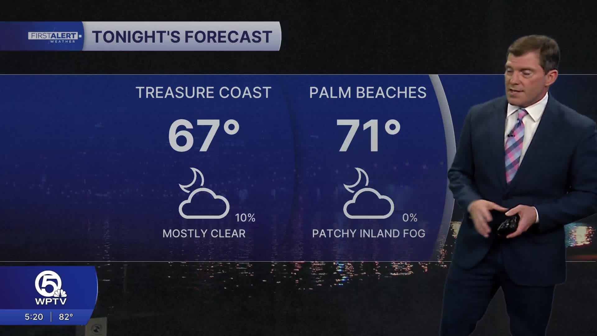


WEST PALM BEACH, Fla. — Patchy fog could once again develop during the early morning hours on Thursday. Inland communities could see dense fog just before sunrise with it lifting shortly after. Overnight conditions will remain mildly warm, with lows settling into the upper 60s-lower 70s.
The first half of Thursday looks mainly sunny and toasty with temperatures soaring into the upper 80s, near 90—near record highs. Changes arrive late in the day as an approaching cold front will bring gusty winds as well as trigger spotty showers and thunderstorms through the evening.
MORE WEATHER: Radar | Alerts | 7-Day Forecast | Hourly Forecast
By Friday, northeasterly winds and slightly drier air will keep highs mostly in the upper 70s to lower 80s. While we will get some sunshine, a few, passing showers are still possible.
Meanwhile, strengthening winds later this week will also lead to rougher beach and boating conditions as seas begin to build Friday through the weekend.
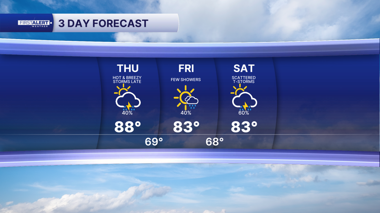
Looking ahead to the weekend and early next week, the pattern stays unsettled. Moisture will increase across the region, bringing higher rain chances Saturday and Sunday along with scattered thunderstorms.
Additional waves of energy in the atmosphere will keep showers around into early next week, with another cold front passing on Tuesday. Temperatures will gradually trend cooler after that system passes, with overnight lows dropping into the 50s/low 60s by mid-week. Daytime highs will be comfortable, only reaching the mid 70s.
**Portions of this story were assisted by artificial intelligence tools and reviewed by a WPTV journalist to ensure accuracy, clarity, and adherence to editorial standards.


