


WEST PALM BEACH, Fla. — Scattered showers are still moving through the area overnight. The good news? Relief is on the way.
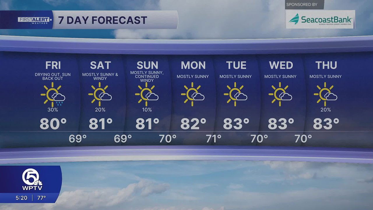
By Friday, drier air takes over, limiting rain chances and allowing for more sunshine. Temperatures will climb into the upper 70s and low 80s, and the warming trend continues into the weekend and beyond.
MORE WEATHER: Radar | Alerts | 7-Day Forecast | Hourly Forecast
Gusty winds continue, with coastal areas seeing wind gusts between 30 and 35 mph and breezy conditions extending inland.
Along the coast, conditions remain especially dangerous. Rough surf with waves reaching 8 to 12 feet and a high risk of life-threatening rip currents make entering the water strongly discouraged.

Boating conditions are also hazardous, and minor beach erosion is possible during high tide. While showers will gradually taper off later today and into tonight as drier air begins to move in, winds will stay breezy through the end of the week and weekend, keeping conditions less than ideal outdoors.
Expect dry conditions and steadily rising temperatures through next week, with some inland areas reaching the upper 80s by midweek. Just don’t let the improving weather fool you—rip currents will remain a serious hazard at the beaches through at least early next week.
**Portions of this story were assisted by artificial intelligence tools and reviewed by a WPTV journalists to ensure accuracy, clarity, and adherence to editorial standards.


