
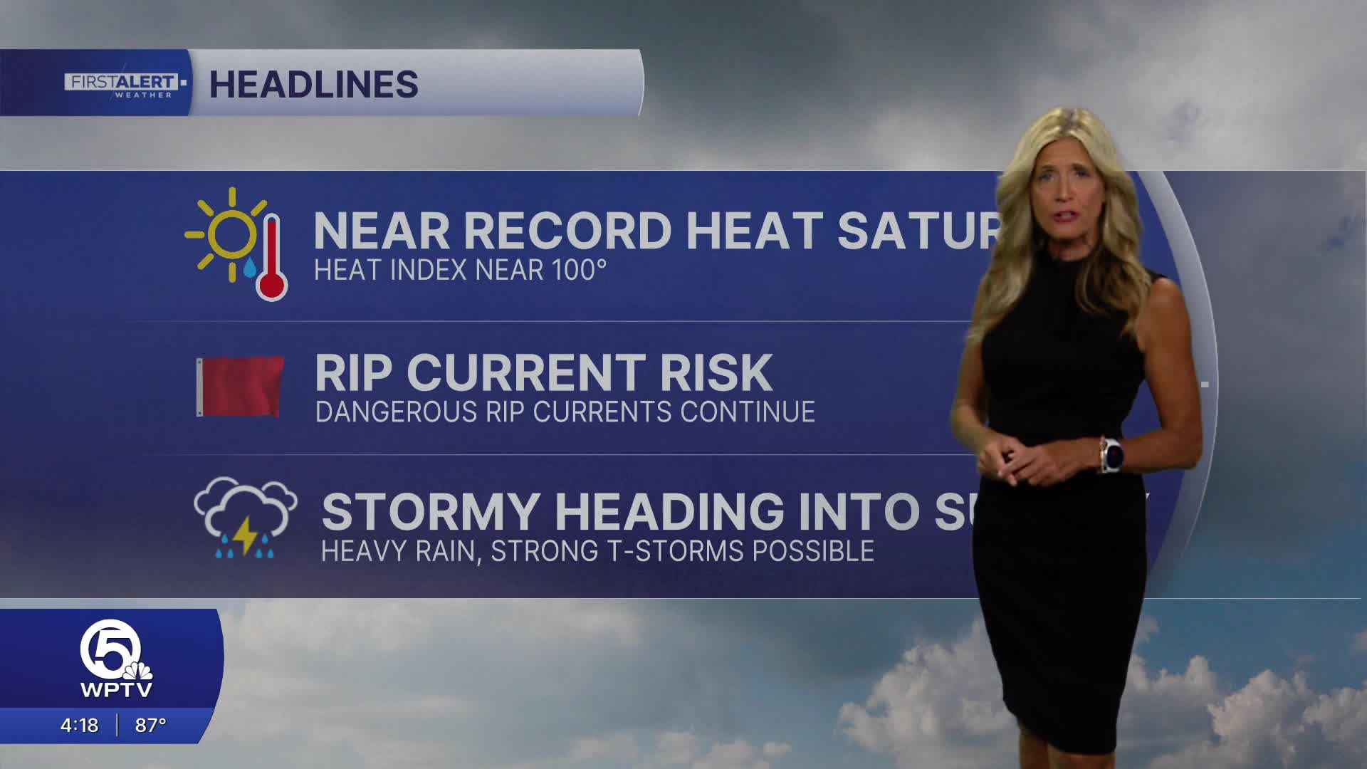


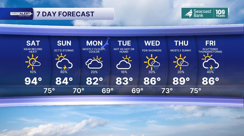
WEST PALM BEACH, Fla. — Get ready for a very hot start to the weekend with high temps well above average.
WSW winds will push temperatures into the low-mid nineties along the East Coast. Inland areas could see highs reach the mid to high 90s. The heat index will make it feel even hotter outside, hitting the triple digits in some areas. Record highs could be in jeopardy on Saturday as we anticipate the hottest day of the year.

The weather pattern changes on Sunday as a cold front moves into the area. It will bring a high chance of showers and thunderstorms on Sunday.
Elevated rain chances are expected to stick around through early Monday morning as the cold front slows down over our region. Behind the front will be a relief from the heat, cooling back down to the lower 80s early next week.
MORE WEATHER: Radar | Alerts | 7-Day Forecast | Hourly Forecast
Portions of this story were assisted by artificial intelligence tools and reviewed by a WPTV journalist to ensure accuracy, clarity, and adherence to editorial standards.


