
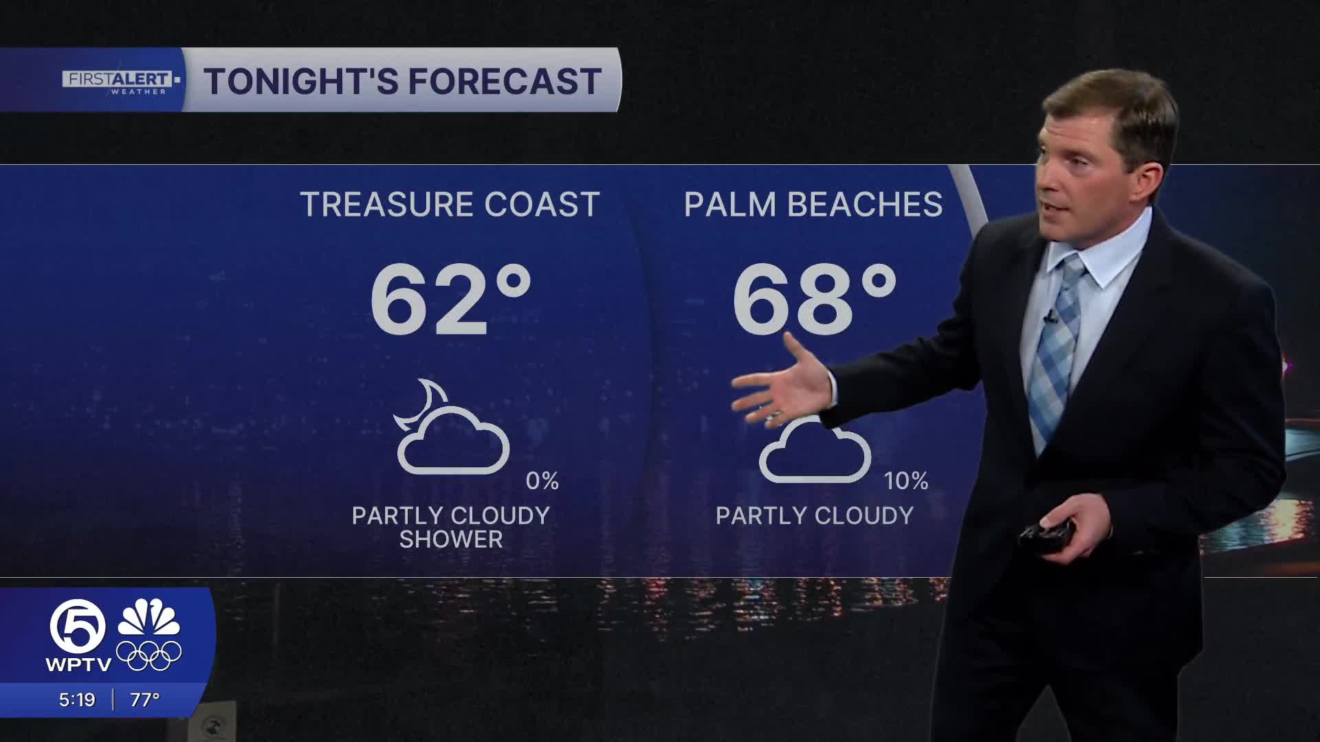


WEST PALM BEACH, Fla. — A few spotty showers are possible Saturday, mainly across the eastern half of the region, driven by sea breezes and lingering moisture.
Temperatures will stay on the warm side through the weekend, generally reaching the low to mid-80s— well above normal for late January.
MORE WEATHER: Radar | Alerts | 7-Day Forecast | Hourly Forecast
Light winds will allow sea breezes to form each afternoon, which may spark a few brief showers near the east coast, but most rain activity should remain isolated and short-lived.
Strong Cold Front Headed to Florida
A strong cold front is expected to move through on Monday, bringing breezy conditions and a chance for scattered showers. Behind it, much cooler and drier air settles in.

By Tuesday, highs may only reach the upper 60s to low 70s, with chilly mornings—especially near and west of Lake Okeechobee.
Looking toward the middle and late part of next week, forecasters are increasingly confident that temperatures could run below normal across South Florida, with the potential for a notable "cool spell."
Details will sharpen over the coming days, so it's a good idea to keep checking back.


