
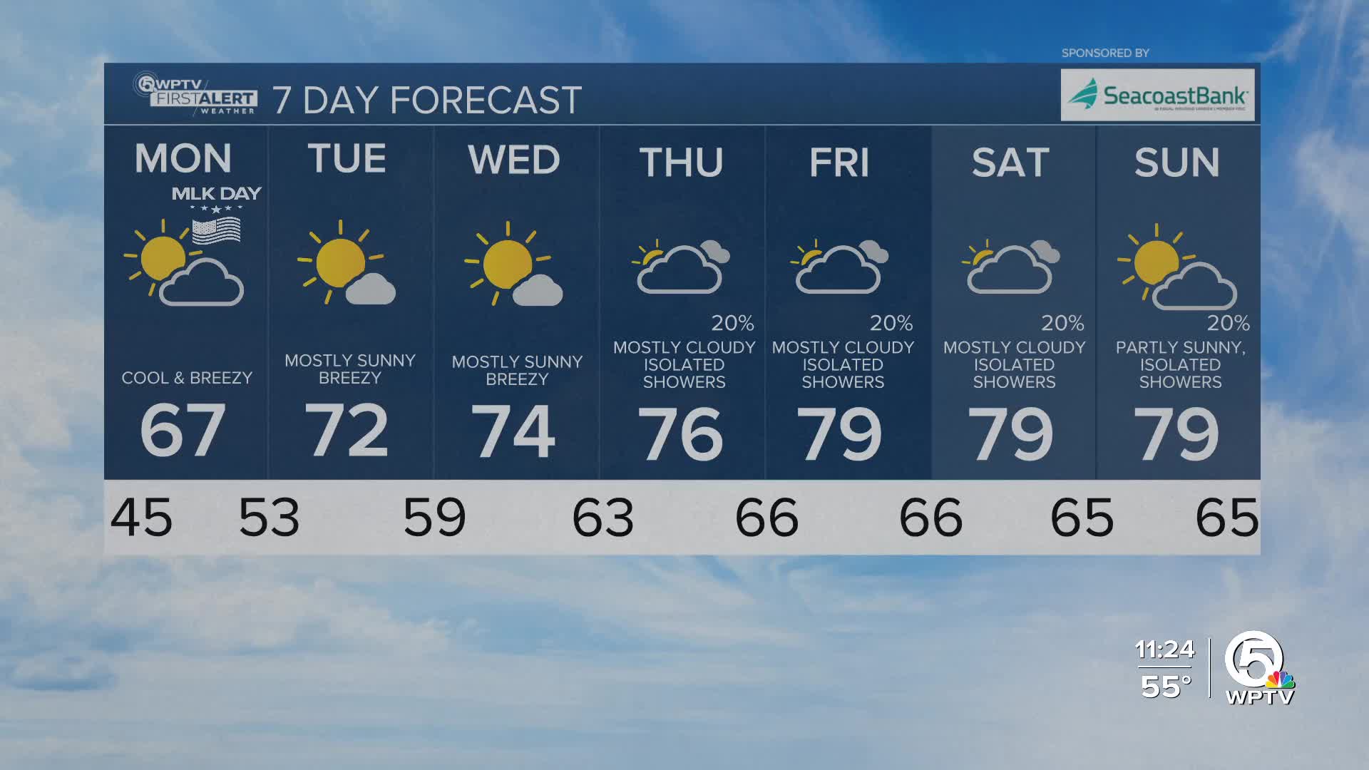


WEST PALM BEACH, Fla. — As the cold front moves further south, the highs winds are subsiding and cooler air is taking over. Breezy conditions will make it feel even colder Monday morning.
A Cold Weather Advisory has been issued for Okeechobee County, Treasure Coast communities and inland Palm Beach County starting at midnight tonight through 9 a.m. Monday due to the threat of wind chills below freezing temperatures.
Overnight lows are forecast to drop into the 40s across the area. Monday will be a partly sunny and cooler day with high temps in the mid to upper 60s.
MORE WEATHER: Radar | Alerts | 7-Day Forecast | Hourly Forecast
With the gusty winds, boaters should also be prepared for rough boating over the next several days. A Small Craft Advisory
has been issued for 5-9 ft waves through Monday afternoon for waters surrounding the Treasure Coast waters and Tuesday for the Palm Beaches.
A slow warming trend follows through midweek reaching the 70s by Wednesday. It will stay breezy through at least the first half of the week.
Looking ahead to later this week, a low-pressure system will try to form over the Florida Straits. This could bring some unsettled weather including more cloud cover and slight rain chances through the of the work week.


