


WEST PALM BEACH, Fla. — High pressure remains firmly in place over the Gulf waters keeping South Florida quiet through the Friday with nothing more than a few coastal showers.
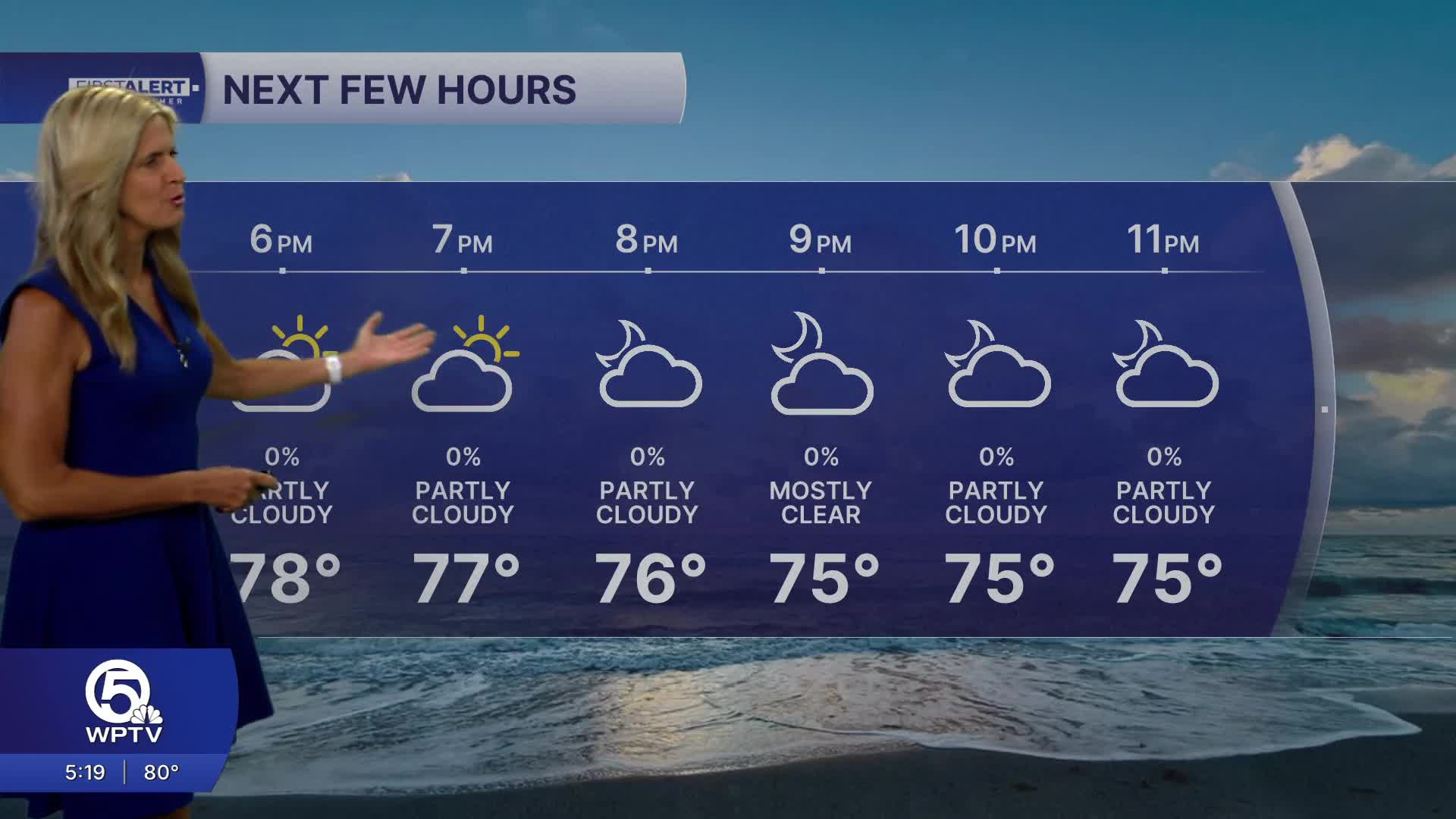
We'll see partly sunny skies on Friday with just a 10% chance of brief,light showers mainly near the coast.
Temperatures will stay warm the next couple of days, with highs reaching the low/mid 80s. Evenings will feel comfortable, dipping into the 60s inland and low 70s near the water.
While the weather may seem beach-perfect, there’s an important safety concern to keep in mind: dangerous rip currents are expected to continue along all Atlantic-facing beaches in South Florida through at least Friday evening. Even experienced swimmers can get caught in these strong currents, so it’s best to stay cautious and follow local beach advisories if you’re heading into the water.
Looking ahead to the weekend, temperatures are expected to climb to above average as the warm, dry pattern holds. Humidity will also be up, making the heat feel more uncomfortable. There could be a few isolated afternoon showers, especially along sea breeze boundaries as they progress inland.
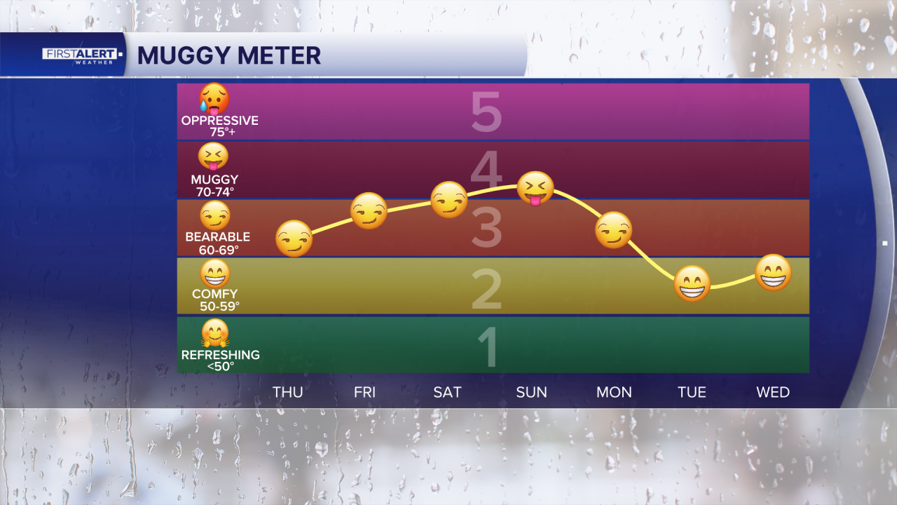
By early next week, a cold front moving down the Florida peninsula may increase rain chances, particularly Monday into Tuesday. While there’s still some uncertainty in how this system will develop, it could bring a brief cool down, with temperatures easing back into the upper 70s and low 80s after it passes. It will also bring back gusty onshore winds so boating and beach hazards will come back next week.

MORE WEATHER: Radar | Alerts | 7-Day Forecast | Hourly Forecast
**Portions of this story were assisted by artificial intelligence tools and reviewed by a WPTV journalist to ensure accuracy, clarity, and adherence to editorial standards.


