
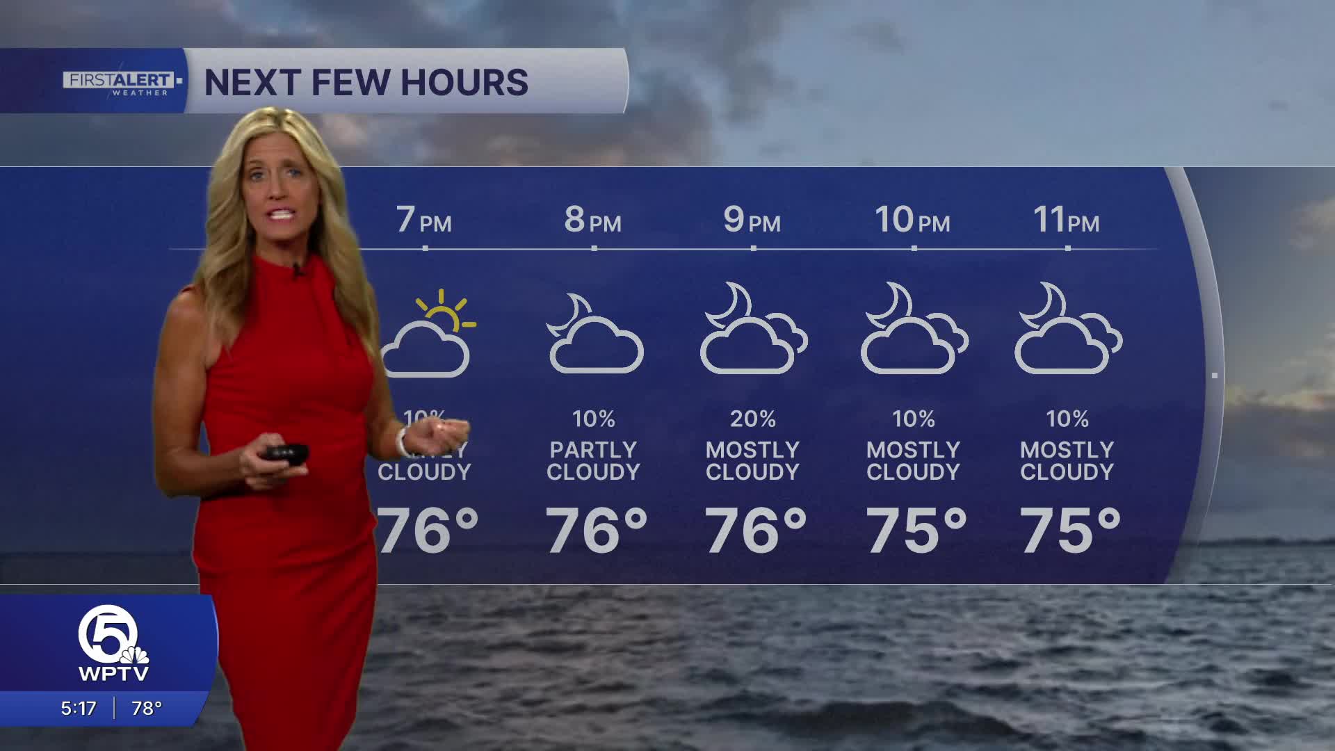


WEST PALM BEACH, Fla. — High pressure across the area will continue to bring us plenty of sunshine on Tuesday.
Dewpoints in the low 60s will keep humidity at bay and an onshore flow will keep temps sightly cooler at the beaches.
While the skies stay mostly clear, those winds and rough surf will continue risky swimming conditions. Other than that, our weather stay pretty quiet through the week - with little to no rain and plenty of sunshine.
MORE WEATHER: Radar | Alerts | 7-Day Forecast | Hourly Forecast
Temperatures will climb day by day, with inland areas heating up the fastest—reaching the upper 80s and even low 90s by midweek. Coastal spots will stay slightly cooler during the day thanks to an ocean breeze, but they’ll also feel warmer at night, with lows hovering in the upper 60s to low 70s.
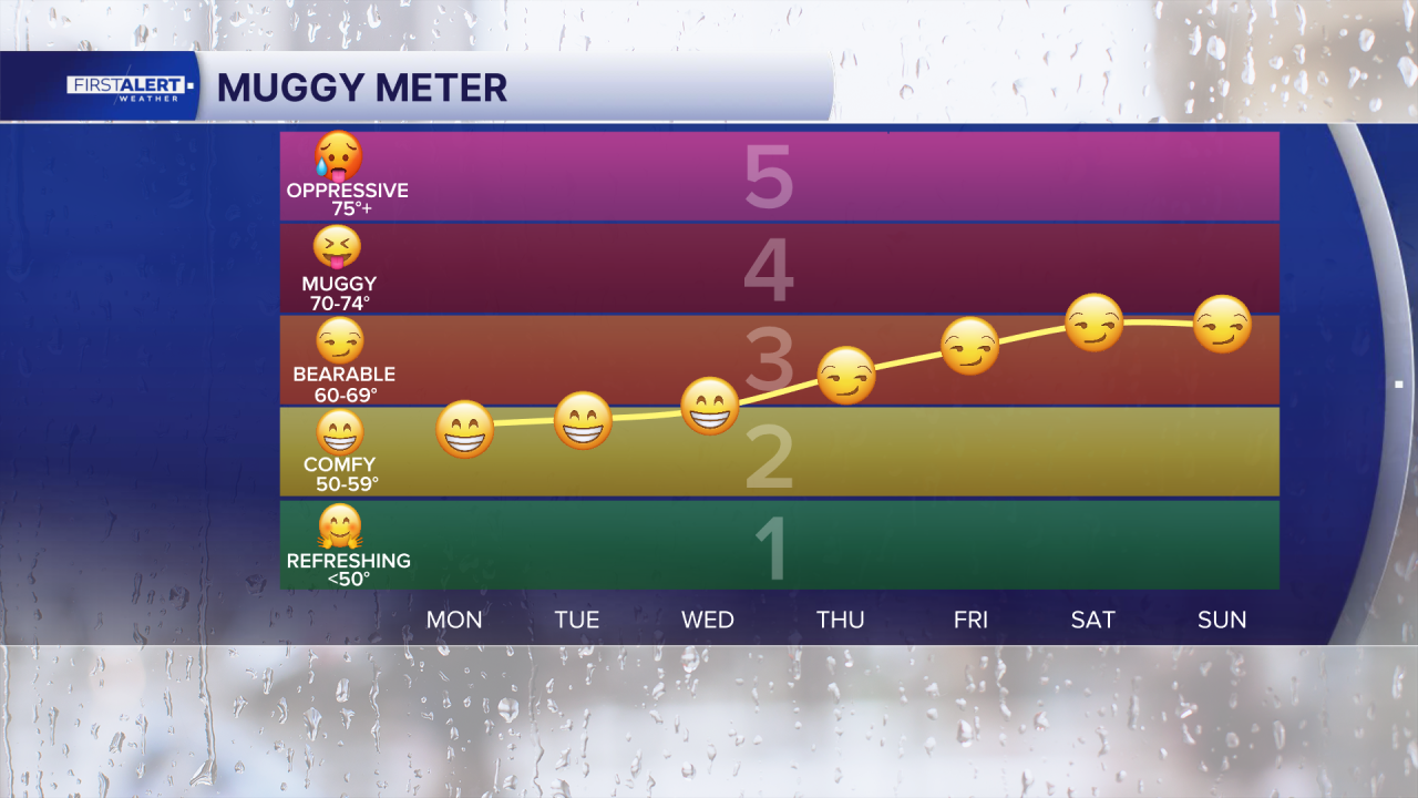
The humidity will also increase by the end of the week, making it feel a little more uncomfortable. Looking ahead, the overall pattern stays warm and mostly dry through the end of the week. Winds will gradually ease, but the heat will stick around.
By the weekend, there’s a small chance for a few spotty showers—mainly along the east coast in the mornings and inland areas later in the day—but nothing widespread just yet. There’s also some uncertainty heading into early next week, as a potential weather system could drift closer to the region. For now, expect classic South Florida spring weather: warm, sunny, breezy, and increasingly hot.
**Portions of this story were assisted by artificial intelligence tools and reviewed by a WPTV journalist to ensure accuracy, clarity, and adherence to editorial standards.


