


WEST PALM BEACH, Fla. — Our unsettled weather will continue into the weekend with intermittent showers and a few storms.
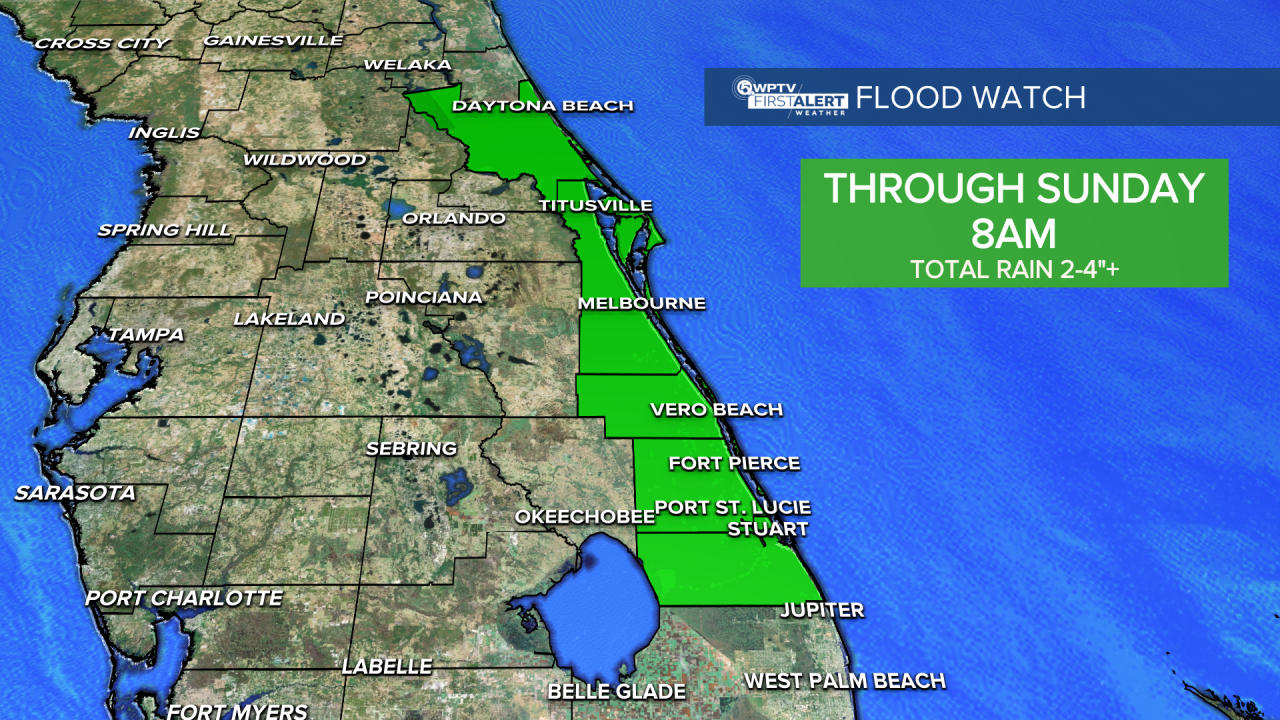
A flood watch is in effect for the Treasure Coast through Sunday at 8 a.m.
A low-pressure system sitting off our coast is pulling in lots of moisture from the Atlantic, setting the stage for repeated rounds of heavy rain in spots. Some areas have already picked up 1- 3 inches overnight, with isolated spots seeing higher amounts.
Additional rain falling on already saturated ground could result in localized flooding — especially in low-lying or urban areas.
In addition to the rain, coastal conditions will remain hazardous. Dangerous rip currents, high surf with 6- to 8-foot waves, and beach erosion are expected to continue through the weekend. If you're thinking about hitting the beach, it's best to stay out of the water for now, as rip currents are likely.
With the seasonal king tide cycle underway, minor coastal flooding is also possible during high tides, particularly along the east coast.
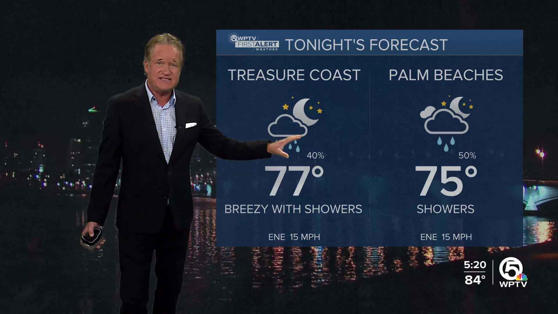
Our high temperatures will continue in the mid and upper 80s, and overnight lows will hover in the low to mid 70s.
It won't be a total washout this weekend, with periods of sun too. However, watch out for localized flooding, and be careful if you're headed to the beach with multiple hazards in place.


