


WEST PALM BEACH, Fla. — Palm Beach County and the Treasure Coast are heading into a noticeably drier stretch, with only isolated, passing showers possible this weekend.
MORE WEATHER: Radar | Alerts | 7-Day Forecast | Hourly Forecast
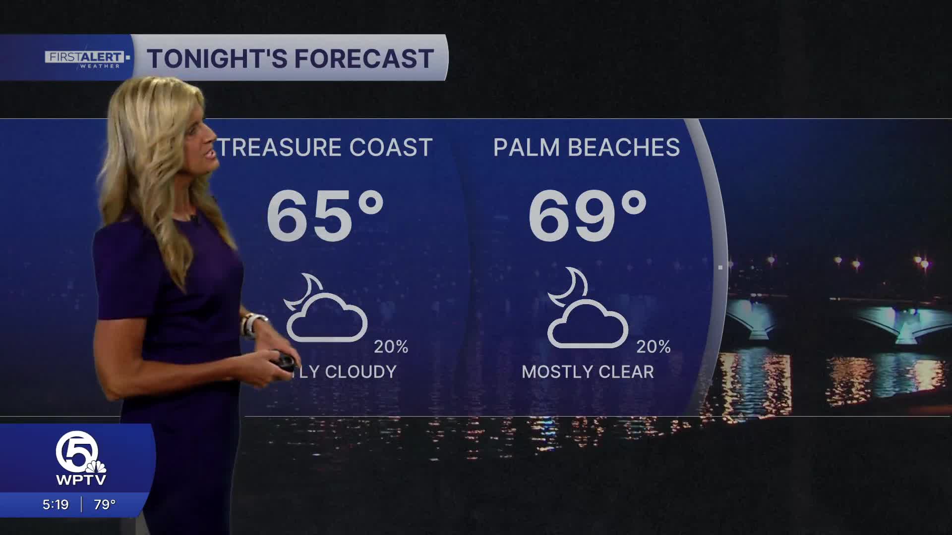
Thanks to a push of drier air and high pressure settling in, rain chances are dropping. Overall, it will be a mild night ahead, with temps falling into the 60s overnight. It'll stay very windy, with wind gusts up to 30 mph possible.
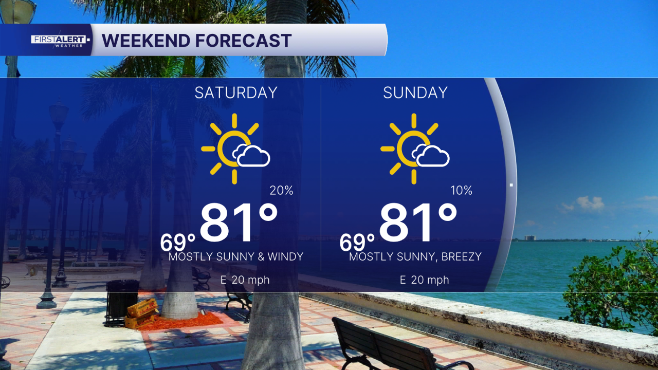
The weekend forecast looks even better—at least on land. You can expect partly sunny skies on Saturday as humidity drops a bit, rain chances fade away. Temperatures will warm back into the lower 80s this weekend.
While the weather looks nice, beach-goers should be cautious: strong onshore winds will continue with dangerous surf and rip currents through the weekend. In other words, the sun may be out, but on the water remains risky. Boating is also discouraged at this time, as a small craft advisory will be in effect all weekend long.
Looking ahead to next week, the warm and dry pattern really locks in. High pressure will stay in control, keeping rain chances very low while temperatures trend upward. Highs will climb from the upper 70s to the mid by Friday. Overnight lows will stay comfortably in the 60s. There’s a slight chance moisture could return late in the week, but for now, expect a stretch of sunny, warm, and mostly quiet weather.
**Portions of this story were assisted by artificial intelligence tools and reviewed by a WPTV journalist to ensure accuracy, clarity, and adherence to editorial standards.


