


WEST PALM BEACH, Fla. — Strong storms moved through the Saturday with some areas seeing up to quarter size hail near Boynton Beach. While the rain is welcoming news for our drought, we need to keep an eye out for fires as lightning can cause trees to smolder for days after storms have passed.
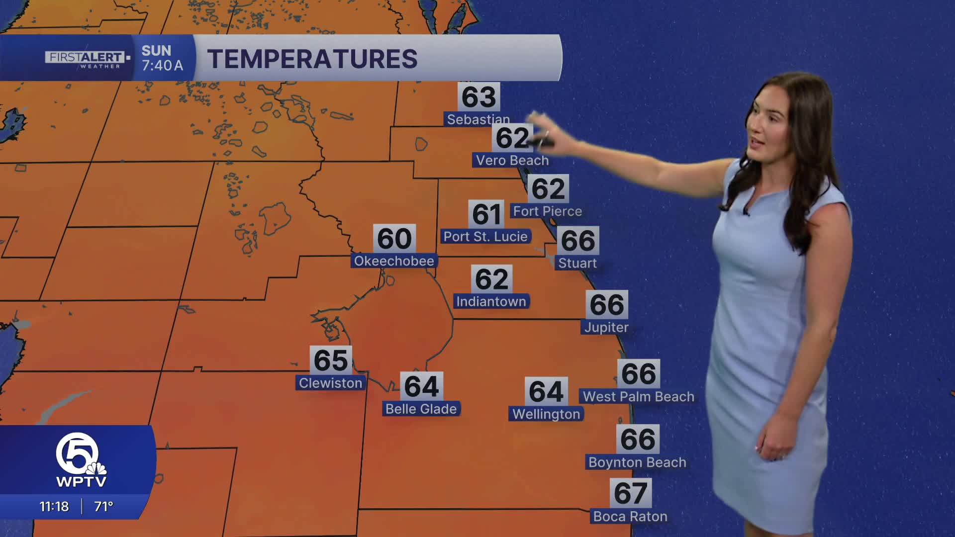
With humid conditions sticking around overnight, patchy, dense fog could develop. Any fog that does develop will lift shortly after dawn. Lows will only fall into the mid-upper 60s.
MORE WEATHER: Radar | Alerts | 7-Day Forecast | Hourly Forecast
For those looking for cooler weather— the weak front will little impact on our temps. Temperatures will remain near or slightly above average into early next week.
Sunday looks to be a fair day with some sunshine and highs reaching the lower 80s.

A few pop-up showers are also possible during the afternoon. overnight lows in the mid to upper 60s.
A developing easterly breeze early next week will keep a small chance of passing coastal showers in the forecast next week, but not the type of widespread or soaking rainfall we need to get us out of the drought.


