


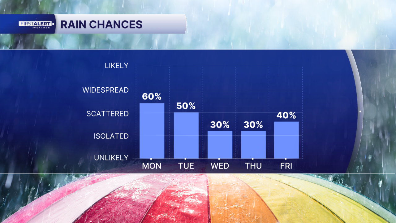
WEST PALM BEACH, Fla. — A typical mid-June pattern remains in place across the region, with hot, humid conditions each day and scattered to numerous afternoon and evening thunderstorms. Storms will be driven by sea-breeze boundaries and abundant tropical moisture, with the greatest coverage often developing inland before drifting toward the coast later in the day.
Partly sunny and very warm this morning, becoming increasingly unsettled during the afternoon with storms developing. Highs generally 89–93°F along the coast and 92–95°F inland. Heat index values will reach 100–105°F in many locations.
Scattered thunderstorms begin developing after noon, with the highest coverage between 3 PM and 8 PM. Slow-moving storms may produce torrential rain, frequent lightning, gusty winds to 40–50 mph, and localized street flooding. Storm chances are highest across western Martin, St. Lucie, Indian River, and Palm Beach Counties before activity spreads eastward toward the I-95 corridor.
Near Lake Okeechobee, storms are expected during mid-afternoon before shifting toward coastal communities during the evening. Heavy downpours and localized flooding remain possible.
Beach & Boating
Atlantic waters remain generally favorable during the mornings, but thunderstorms will create rapidly changing conditions each afternoon. Lightning, sudden wind gusts, and rough seas will be the primary hazards near storms. Beachgoers should also be prepared for very high UV levels early in the day and dangerous lightning during the afternoon hours.
MORE WEATHER: Radar | Alerts | 7-Day Forecast | Hourly Forecast
**Portions of this story were assisted by artificial intelligence tools and reviewed by a WPTV journalists to ensure accuracy, clarity, and adherence to editorial standards.


