
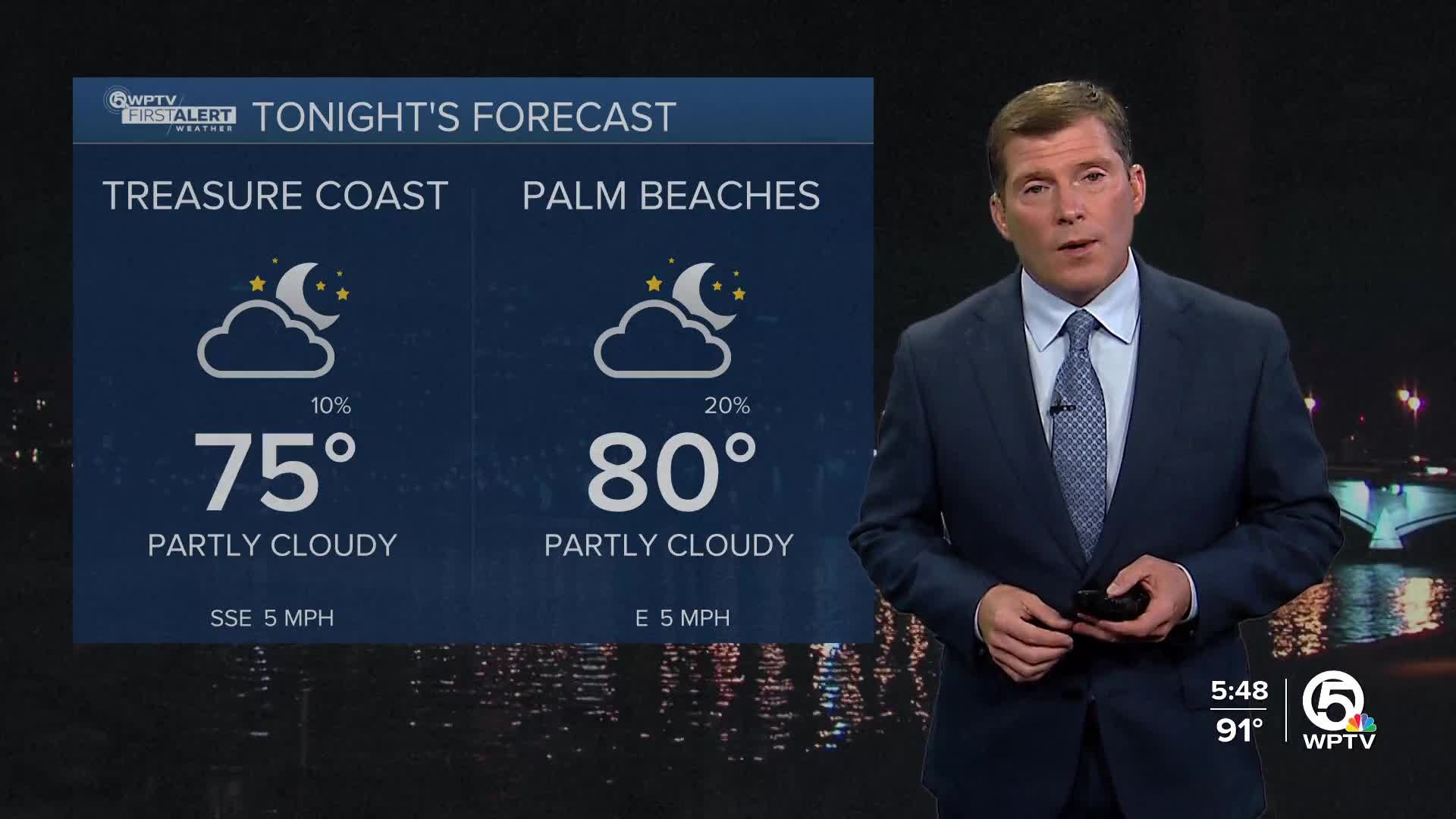


WEST PALM BEACH, Fla. — A few inland showers this evening, but mostly clear skies tonight. Overnight lows in the middle to upper 70s.
MORE WEATHER: Radar | Alerts | 7-Day Forecast | Hourly Forecast
It will be a very hot and humid day again on Wednesday with highs in the lower 90s. Isolated showers and storms are expected in the early afternoon, starting near 1 p.m. Not everyone will come across an afternoon storm.
Highs in the lower 90s on Thursday with heat indices in the triple digits. A high-pressure system is starting to build, which will limit our rain chances to be more isolated along the sea breeze in the afternoons.
We will carry this trend into the weekend with highs in the lower 90s and isolated storms each afternoon.
Over the weekend, we will likely see a higher rip current risk and the wave heights along the Space Coast and parts of the Treasure Coast will increase slightly as Tropical Storm Erin moves north far off our coast.


