

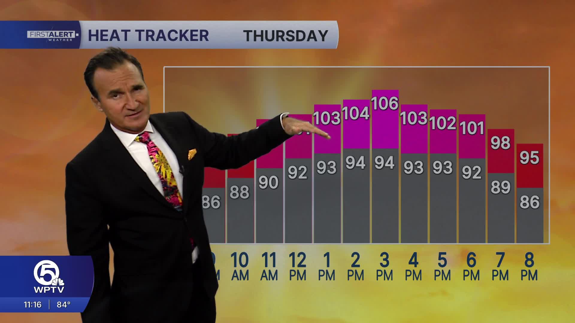


WEST PALM BEACH, Fla. — It was another hot day across the Palm Beaches and Treasure Coast, with afternoon temperatures climbing into the mid-90s and heat index values reaching 103 to 109 degrees.
As we move through the evening, we're watching for isolated to scattered thunderstorms, most of us will remain dry.
Storms will diminish after sunset, leaving behind partly cloudy, warm, and humid conditions overnight. Temperatures will only fall into the upper 70s to around 80 degrees overnight, making for another muggy night.
Tomorrow brings another day of dangerous heat, with afternoon highs in the mid-90s and heat index values once again climbing into the triple digits.
Saharan dust will continue to linger over South Florida through much of the day, keeping storm coverage lower than average, but not completely eliminating the chance for afternoon thunderstorms. The best opportunity for storms will once again be inland during the late afternoon, especially west of I-95 and around Lake Okeechobee. A few storms could drift toward the coast during the evening.
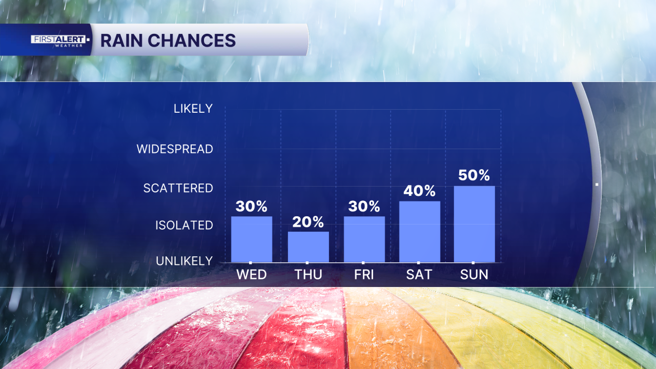
The weather pattern begins to shift as we head into Friday, with increasing moisture allowing storm chances to climb. Saturday currently appears to be the wettest day of the next seven days, with scattered to numerous afternoon thunderstorms expected before a more typical summertime pattern continues into early next week.

MORE WEATHER: Radar | Alerts | 7-Day Forecast | Hourly Forecast


