


WEST PALM BEACH, Fla. — Tonight, it will be warm and humid. Only a few passing clouds are in the forecast for the night. Lows will head into the mid-upper 70s for inland areas and down the Treasure Coast to about 80 in the Palm Beaches.
MORE WEATHER: Radar | Alerts | 7-Day Forecast | Hourly Forecast
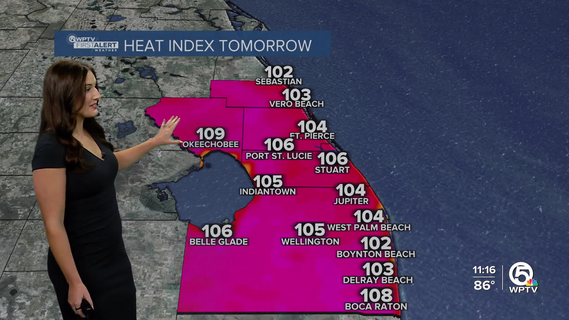
Saturday will be mainly sunny and another scorcher with highs in the lower-mid 90s. Heat indices will near 105 tomorrow with inland spots hotter. Okeechobee could top 110, so a heat advisory will likely be issued for the county.

If you plan on spending time outside this weekend, make sure you and your loved ones are staying hydrated and taking breaks in the shade or A.C.
On Saturday, isolated storms will pop-up in the afternoon, mainly west of I-95. High pressure will continue to move away throughout the weekend which will slowly increase our rain chances.
With an onshore breeze, a couple of isolated showers are possible near the coast late Sunday morning with inland storms setting up Sunday afternoon. Rain chances are near 40%. Highs will work their way into the lower-mid 90s.
We will continue to track an uptick in rain chances through next week.


