


WEST PALM BEACH, Fla. — The first cold snap may be in our past, but we have another one coming late this weekend.
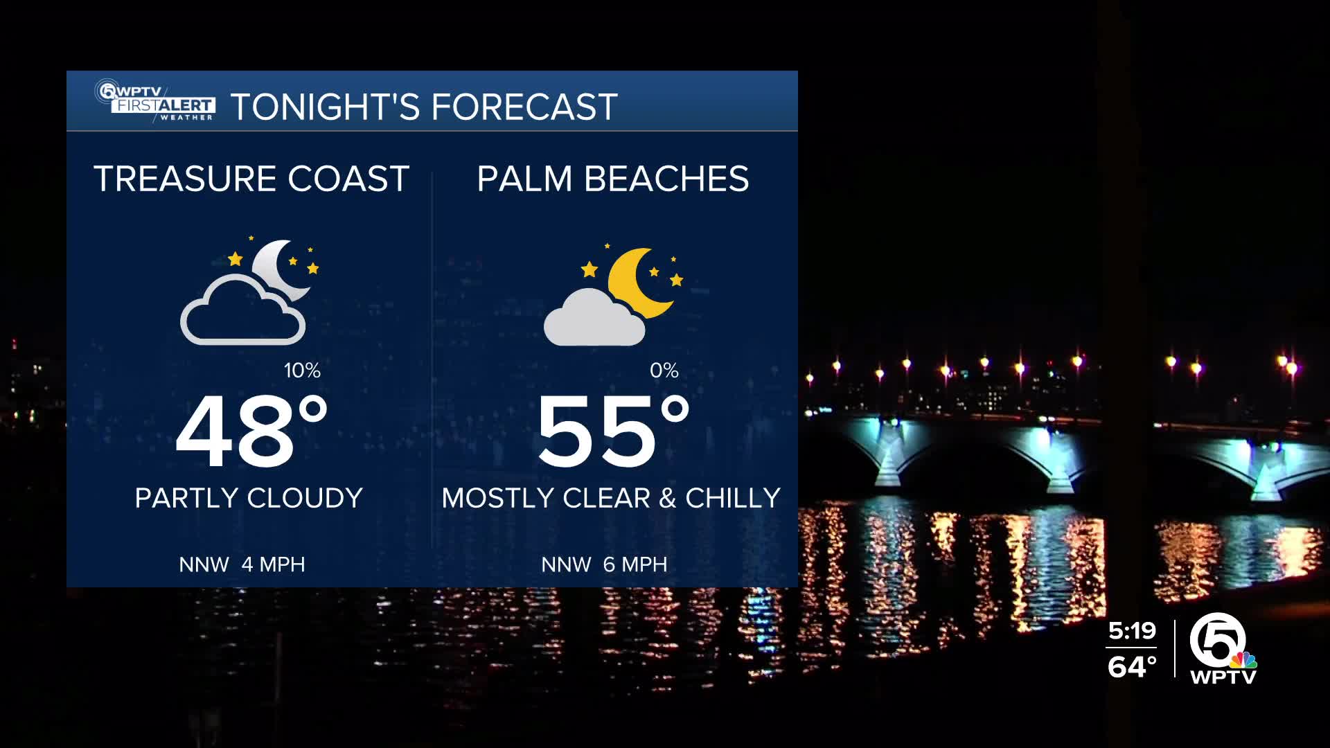
Tonight will be on the chillier side with temperatures falling into the upper 40s-mid 50s by Saturday morning. You will need a jacket before heading out in the morning.
Once we warm up, Saturday looks pleasant with a mainly sunny sky and highs rebounding to the mid 70s.
Sunday's forecast features a little more cloud cover as another strong cold front moves in from the north.
Marine and beach conditions improve Saturday, but it will get choppy again as the wind picks up again late Sunday.
MORE WEATHER: Radar | Alerts | 7-Day Forecast | Hourly Forecast
While not much rain is expected, the front will bring in breezy conditions and the potential for another round of very cold mornings early next week, including the chance for additional freezes inland.
MLK Day starts off cold in the morning, but the sun will help thaw us out bringing highs into the 60s. Next week features more sunshine and a slow warm-up.


