


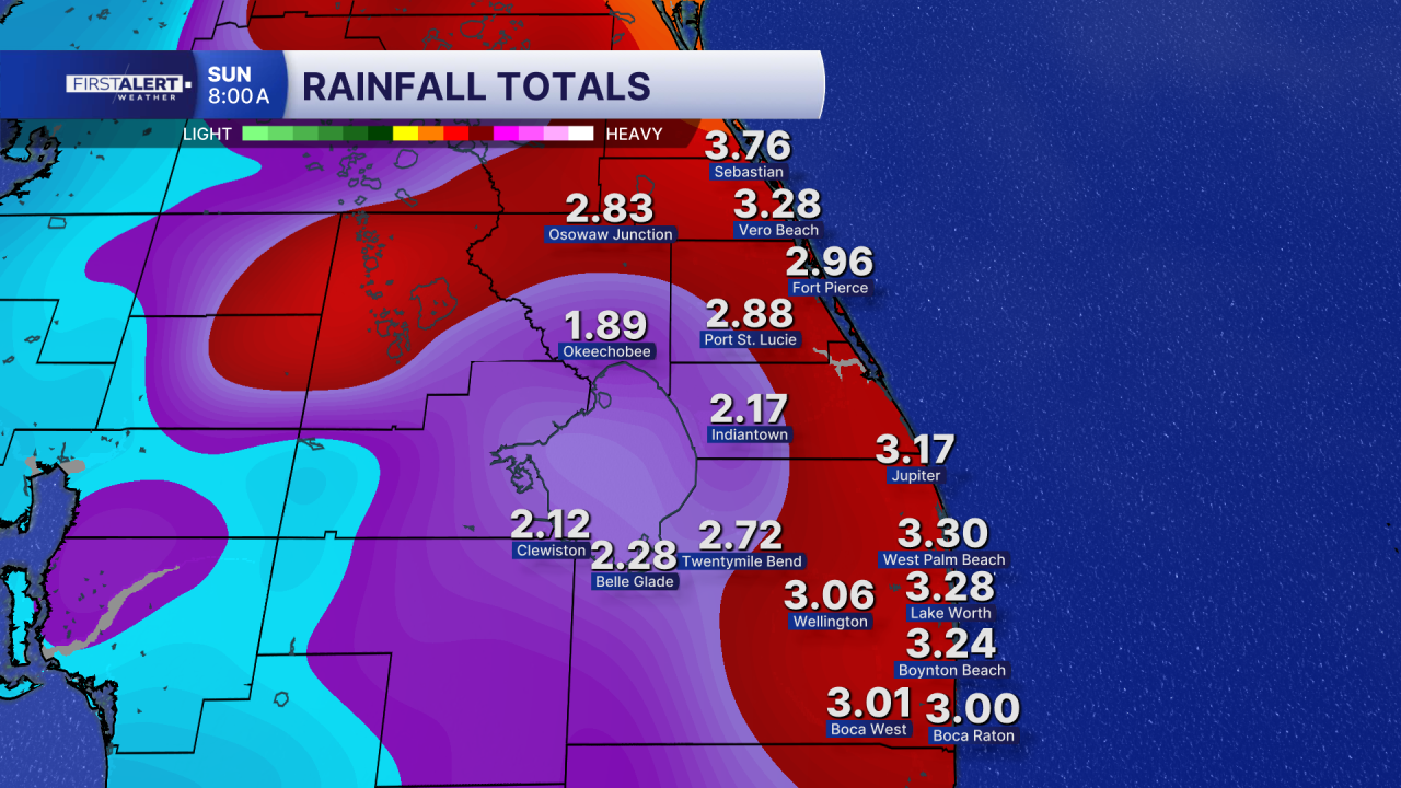
A Flood Watch for Palm Beach County and the entire Treasure Coast has been extended through Wednesday at 10 p.m. Excessive rainfall is possible and may result in flooding of urban areas and poor drainage locations.
MORE WEATHER: Radar | Alerts | 7-Day Forecast | Hourly Forecast
A Wind Advisory is in effect for Indian River, St. Lucie, Martin and Okeechobee counties from 5 p.m. Tuesday until 8 a.m. Wednesday. Gusty winds can blow around unsecured objects, and power outages are possible.
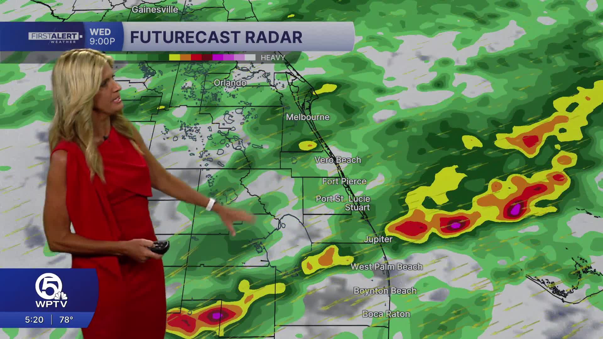
South Florida will continue to see unsettled weather through Thursday, with heavy rain, gusty winds and dangerous beach conditions all in play. A stalled front just to our south along with an area of low pressure is pulling in deep tropical moisture, setting the stage for multiple rounds of rain.
A wind advisory remains in effect through Wednesday morning due to sustained wind speeds between 15 to 30 mph with wind gusts up to 50 mph at times.
Periods of heavy rain on Wednesday could lead to localized flooding, particularly in low-lying and poor drainage areas. Most locations can expect 1 to 3 inches of rain, but some coastal communities could see 4 to 6 inches or more where storms repeatedly move over the same areas.
Building onshore winds will create rough surf and a high risk of rip currents along the Atlantic beaches continuing through late week. Wave heights could reach 7 to 10 feet, especially on Wednesday. It’s strongly advised to stay out of the ocean.


