


WEST PALM BEACH, Fla. — A Wind Advisory is in effect for coastal Palm Beach, St. Lucie, Indian River and Martin counties through early Thursday morning.
MORE WEATHER: Radar | Alerts | 7-Day Forecast | Hourly Forecast
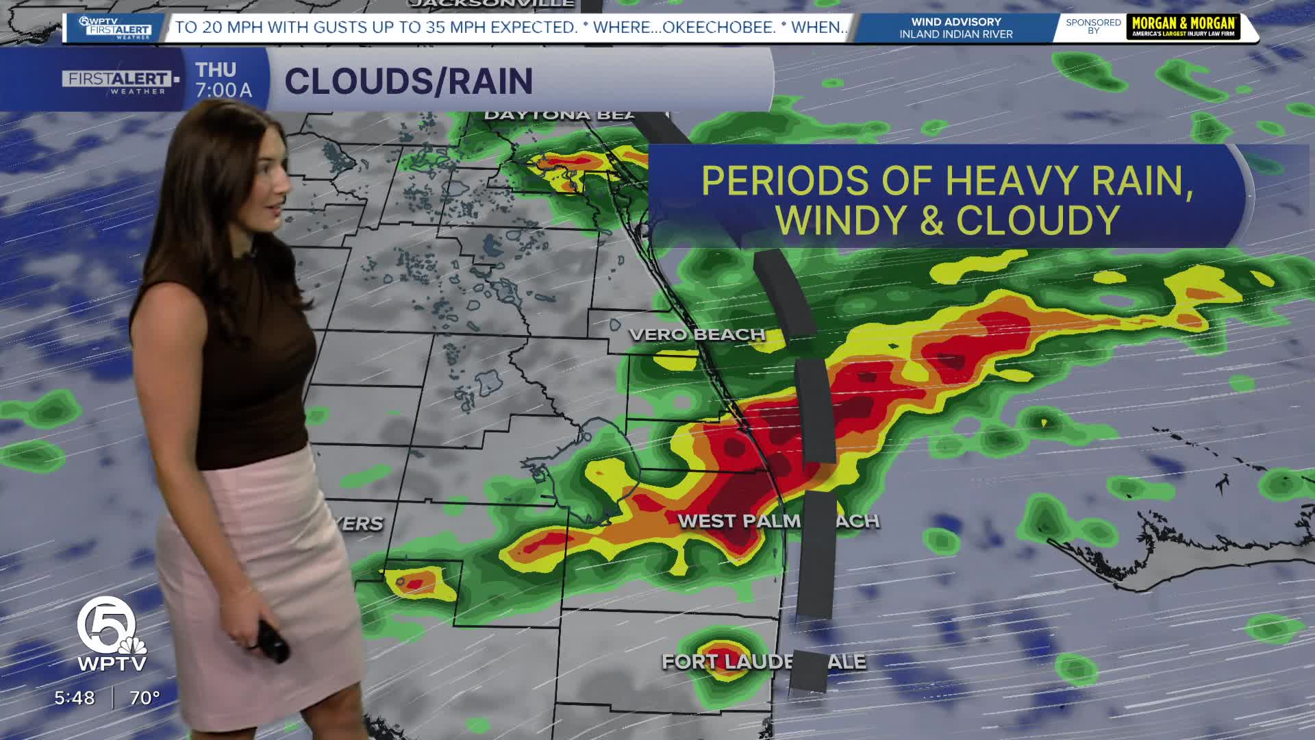
The flood watch has expired for the coast, however, Florida’s unsettled weather isn't letting up just yet. Additional rounds of heavy rain are expected Thursday with a few thunderstorms mixing in as well. Most areas will see under an inch of rain however, some spots could pick up an additional 2+ inches of rain, raising the risk of localized flooding—particularly in urban and poorly drained areas that have already recieved quite a bit of rainfall already.
It’s not just the rain—strong northeast winds are also making an impact. Gusts of 35 to 45 mph along the coast and up to 35 mph inland will keep things blustery through the morning.
At the beaches, conditions are especially dangerous. Waves reaching 8-12 feet are creating life-threatening rip currents, and forecasters are urging everyone to stay out of the ocean. High tides may also push water up to the dunes, leading to minor to moderate beach erosion in some areas.
A High Rip Current Risk and High Surf Advisory is in effect for coastal Palm Beach, St. Lucie, Indian River and Martin counties until Friday evening. A small craft advisory has been issued for the coastal waters as boating is strongly discouraged at this time.
The good news? A major pattern shift is on the horizon. By Friday, drier air and high pressure will begin to take over, bringing a much-needed break from the rain.
The weekend looks mostly dry, with just a slight chance of a passing shower on Friday evening.
Temperatures will gradually warm, climbing into the 80s early next week — and possibly even higher inland. While beach conditions may remain rough for a bit longer, the overall trend points toward calmer, sunnier days ahead.
**Portions of this story were assisted by artificial intelligence tools and reviewed by a WPTV journalist to ensure accuracy, clarity, and adherence to editorial standards.


